Doctoral dissertation: formation of the image of the territory. Modern approaches to forming a tourist image of a territory
Ministry of Science and Education of the Russian Federation
Federal Agency for Education
State educational institution
higher professional education
"Kursk State University"
Faculty of Natural Geography
Direction 050100 (540100) Natural science education
Master's program 540103 M Geographical education
Full-time education
Department of Physical Geography and Geoecology
GRADUATE QUALIFYING WORK
(MASTER'S DISSERTATION)
ON THE TOPIC
« Formation of a geographical image of a territory when studying countries in the course “Economic and Social Geography of the World”
Performed:
2nd year student
master's degree
Kashkina Irina
Alexandrovna
Scientific adviser:
Ph.D. ped. sciences,
Kozlova Galina
Vasilevna
Kursk 2011
Content
Introduction …………………………………………………………………………………3 CHAPTER 1. Geographical image of the territory and the conditions for its formation
1.1. The concept of geographical image……………………..................................5
1.2.Genesis and modifications of geographical images....................................12
1.3.Psychological and pedagogical conditions for the formation of geographical
images……………………………………………………………………...... ...15
CHAPTER 2. Formation of geographical images of the territory of countries in the course
economic and social geography of the world
2.1. The regional studies component of the course as the basis for the formation
images of territory…………………………………………………….26
2.2. Techniques and means of forming geographical images
territories of countries among high school students……………………………….30
CHAPTER 3. Experimental work on the formation of geographical
images of the territory of countries in the course of economic and social
Geographies of the world
images of the territory of countries in high school………………………..57
3.2. The effectiveness of experimental work on the formation
geographical images of countries in the course of economic and social
world geography……………………………………………………….66
Conclusion……………………………………………………………..78
List of references…………………………………………………………….79
Application
Introduction
The main task of geographical education is the formation of geographical culture, which is part of the general human culture. In this regard, one of the most important components of education is geographical thinking, which is part of the concept of geographic culture and is the basis for the formation of geographical images. Geographical thinking is based on a system of geographical knowledge and skills. The formation of geographical concepts begins with ideas. Therefore, when studying geography, there is an obvious need to use additional tools that promote deeper assimilation of knowledge through the formation of geographical images.
An image is one of the forms of reflection of real reality in the human mind, which is created with the help of the senses and at the level of thinking. The image of the territory is the students’ real idea of it, which contributes to the development of cognitive interest in the material being studied and the subject in general. The uniqueness and originality of the objects being studied creates an emotional perception of educational information, which will allow students to form a stable idea of a particular territory in their memory. Everything noted above indicates the relevance of the problem being studied.
Target This study is to identify the features and possibilities of forming geographical images of countries in the course of economic and social geography of the world.
In accordance with the goal, the following were settasks:
1. Define the concept of “geographical image of the territory”, psychological, pedagogical and methodological conditions for its formation.
2. Show various ways, means and techniques for forming geographical images of the territory.
3. Develop methodological recommendations for the formation of geographical images of countries in the course of economic and social geography of the world; test and determine the effectiveness of the developed recommendations during scientific and pedagogical practice.
Object of study is the process of forming geographical images when studying the course of economic and social geography of the world.
Subject of study – a methodology for the formation of geographical images when studying the course of economic and social geography of the world.
During the study, the following methods were used: analysis of psychological, pedagogical and methodological literature, survey, questionnaire survey of geography teachers and students in grades 10-11, pedagogical experiment.
The theoretical basis of the study is the work of such authors as V.P. Maksakovsky, N.N. Baransky, D.N. Zamyatin, G.A. Kononova and others.
The research hypothesis is that the formation of geographical images of countries in the course of economic and social geography of the world will be an effective type of educational work if it is carried out through educational methods associated with the use of a system of tasks that require a creative approach. The use of a system of tasks will be relevant provided that visual aids and additional literature are used as illustrations of the material being studied.
CHAPTER 1. Geographical image of the territory and the conditions for its formation
1.1. The concept of the geographical image of the territory
The expansion and deepening of the border areas of social scientific and humanities-scientific knowledge poses challenges for modern geography to expand and deepen the subject and object of research, to include new methods and ways of scientific knowledge of the world. This problem is activated by the concept of a geographical image. Currently, the concept of a geographical image is found relatively rarely in scientific geographical research, often as an addition to traditional concepts and research methods. The reasons for this situation are, first of all, the insufficient methodological “expandability” of modern geography to the social and human sciences.
The solution of important social problems, in the study of which geography can and does take part, is directly related to the increasing “humanitarianization” of both the problems themselves and the methods and means of solving them. The development of humanities and scientific research related to the problems of “images” of individual regions and the formation of the image of countries in the tourism business automatically poses the problem of more effective participation of modern geography in solving these problems. Therefore, one of the main tasks is to show that the development of a methodology for modeling geographical images is necessary both from the point of view of the methodological and theoretical development of modern geography, and from the point of view of effective participation in solving many socially significant problems.
An image is one of the forms of reflection of reality in the human mind. It is created both with the help of the senses and at the level of thinking: concepts, judgments, conclusions. Therefore, you can create an image using words, visual aids, and practical action. The image of the territory is the students’ real idea of it, which contributes to the development of cognitive interest in the subject. The very uniqueness and inimitability of the objects being studied creates an emotional perception of this information, which will allow students to form a stable idea of a particular territory in their memory. Everything noted above indicates the relevance of the problem being studied.
A geographical image arises or is constructed as a result of the intersection and interaction of various geographical or parageographical concepts. Parageographical concepts include any cultural, historical, political, economic and other concepts. In a general sense, a geographical image is a set of bright, characteristic signs, symbols, key ideas that describe any real spaces (territories, localities, regions, countries). Geographic images can take different forms depending on the goals and objectives, the conditions of their creation, and finally, on the creators of the images themselves.
The formation of images in geography are elements of a consistent spatial understanding of the surrounding world, during which the structures of spatial understanding develop. The image in geography is inseparable from the structures of spatial thinking. Spatial thinking also combines procedural knowledge, i.e. knowledge of how to act, and declarative knowledge, i.e. the totality of past experience about certain events and actions. Speaking about the relationship of geographical images with various spheres of human activity, it is necessary to turn to their genesis. Space and its images are created by culture and civilization. Each culture creates certain images of geographical space; these are its integral elements.
The process of presenting geographical images is based on the use of texts of various origins: scientific and artistic, newspaper articles and information notes, official documents, advertising. Graphics, painting, music, cinema and video, the Internet are also an important means of representing geographical images.
The emergence and development of the concept of geographical image
For many decades, along with a deep and productive interest in history and historiosophy, there was a rather cool attitude of philosophy towards the methodological problems of geography. We are talking here, of course, not about the well-developed problems of space in philosophy, but about the direct turning of the interest of philosophy to borderline, interdisciplinary problems. The existence of geophilosophy will be directly related to the specific contributions of interested researchers.
Further approaches to the philosophical understanding of geographical space are studies of mythological archetypes of the development of earthly space, in particular, the work of Mircea Eliade. The attention of this researcher was directed to identifying the structural mechanisms of the transformation of celestial mythological and religious archetypes into specific models of the development of earthly space. Geographical space in this case changes its configurations depending on the sacred and mythological “coloring” of the author of this spatial-geographical experiment (a certain system of religious or mythical ideas). Geographical space as a certain archetype is the minimum necessary visionary position, which is conducive to further emerging, “releasing” it as a subject of possible philosophical interest.
Further search in this area is associated with the names of Michel Foucault, Gilles Deleuze and Felix Guattari. Foucault was the first to come into contact with geographical thought; this was, apparently, one of the first attempts at philosophizing, which was a response to a direct geographical “order”. This position dictated a strictly oriented point of view - geographical space in this case is nothing more than a consequence of purposeful mental or philosophical efforts, which, as it were, directly and “personally” literally construct and shape it around themselves. The entire geographical space becomes, as it were, central, while the center can constantly move. The idea of geographic space has grown and turned into geographic space itself - to the extent that it is necessary for its own awareness and functioning.
Subsequently, this position of Foucault was transformed. The space of philosophical experience was equated by him to the actual geographical space, and the geographical space itself could act only as a strictly functional, specialized, specific space of human activity.Political organization, the space of political power cannot be separated from the actual geographical space in which they are formed; It is the same.In the case of Foucault, the image of a previously unified geographical space was fragmented, fragmented into many rigid, “service” spatial images, which form the mosaic of the spatial experience of a particular person. There was a peculiar implantation of geographical space as a subject of philosophizing into the sphere of a much broader mental search, in which it became a direct instrument of thought. Thought itself has become a spatial-geographical phenomenon, a spatial-geographical phenomenon, or at least recognized itself as such.
The joint work of J. Deleuze and F. Guattari "What is philosophy?" showed that philosophy actively comprehends the concept of geographical space and, moreover, tries to increase its “volume”, as if at the expense of geography. The concept of geophilosophy put forward by these thinkers develops on the basis of the most general geographical images - land and territory. Two processes determine their relationship - the process of deterritorialization (opening the territory outward, from territory to land) and the process of reterritorialization (from land to territory, restoration of territory through land). It is these transitional zones between philosophy and geography that allow us to talk about playing with geographical space. Thought is shaped by geographic space and becomes, in essence, the form of that space; otherwise: the “geographical location” of thought occurs.
Modern Russian philosophizing in the field of geographical space is associated, first of all, with the research of V. A. Podoroga. Using the examples of the works of Kierkegaard, Nietzsche, and Heidegger, he managed to show the role and significance of specific geographical images in the formation of philosophical works. It is especially important for the researcher to comprehend border spaces, or space-on-the-border - those still extremely poorly described geographical images, which in fact very strongly stimulate philosophizing itself, even to some extent determine its very structure.
The works of V. A. Podoroga signified a fundamental turn, previously almost unnoticeable, in the problems presented. Geographical space turned out to be an important and organic condition for philosophizing itself. Geographical images seem to permeate the structures of philosophizing and actually determine their effectiveness. The space of geographical images acted as a natural field or context for any possible and potentially productive, self-oriented thought.
The most productive was the line of philosophizing that was associated with geographical images of movement, with the dynamics of geographical space. Travel as the pinnacle of geographical self-knowledge and at the same time as an extremely strong position of “geographically” oriented philosophizing has attracted serious attention from researchers. In the first case (the study of the poetics of wanderings in the work of O. E. Mandelstam), geographical space and its dynamic landscape images became an expression of the frank expansion of “inner”, “mental” space. Unique spatial systems are formed that set the rhythm of change in the geographic space itself in accordance with the internal settings of a real or poetic journey. Spaces themselves seem to change their images, under the “pressure” of paths laid everywhere: “... as roads are laid from one space to another, the role and meaning of these spaces in human life changes, the real landscape of the human world undergoes a change: roads straighten, mountains they become lower, the seas become calmer, the deserts become smaller, the fields become wider, etc. “Regionalization” of the area occurs.” A single, constantly expanding field of geographical images appears, and these images themselves are in various stages of formation. Travel modalities establish specific systems of priorities, values of geographical images of different genesis and structural types: poetic, artistic, naturalistic, etc. A position is already possible, as if “hovering” over the very trajectory of a specific, real or imaginary, journey; the metaphysics of travel is a completely attractive topic that can stimulate the creation of entire “clusters” of geographical images.
Geographical philosophizing, which was aimed at understanding the role and meaning of various geographical images and geographical space, developed in the 1980-1990s among professional geographers. Going beyond the limits of their traditional competence, geographers asked questions that, despite their traditional formulation, carried within themselves the “grains” of an unconventional, seemingly vague and at the same time strictly chorological approach. Thus, the study of the image of a place turned out to be very important from the standpoint of classical applied geographical research in electoral geography, geography of small business and local government. The development of an entire cultural heritage industry has led to an awareness of the importance of forming and cultivating images of certain geographical places. This methodological orientation was based on the recognition of the importance of the geographical imagination, which was based on a real, physical place, but then developed the images it needed on this basis.
1.2. Genesis and modifications of geographical images
It is quite obvious that geographical space as an object of research and scientific interest has always been in dynamics. The very image of the object changed its outline, but in this case these changes were superimposed on the specifics of the object itself - the geographical space initially multiplied in the form of various geographical images, which at each specific moment in time satisfied the needs of the scientific community.
The chorological “revolution” in geographical science, begun by the works of the German geographer Karl Ritter in the first half of the 19th century and actually completed at the beginning of the 20th century by Alfred Höttner, was primarily a methodological revolution. As a result, a completely new geographical language appeared, which was characterized not so much by the abundance of new scientific terms (this was only a consequence), but by a fundamentally different attitude to the description of its own object - geographical space. Geographical images, as a result of the chorological approach to the study of geographical space, could arise, intersect and interact with each other, “line up” in a certain sequence. Thus, the classic representation of the image of a country for geography was fragmented into many interconnected, detailed and often even multi-temporal “smaller” images, which seemed to form a general figurative-geographical field. This is especially noticeable in the case of border disciplines - for example, geohistory. The alternating dynamics of these images creates a systemic cumulative effect, which contributes to the accumulation of possible changes in the future and at the same time the interpenetration of various multi-temporal characteristics of the images themselves.
Structurally complex and heterogeneous geographical images could themselves contain a set of rather contradictory and diverse geographical images that created a generally unified and purposeful context for the perception of a particular geographical space. It became possible, in fact, to consciously construct generalized macrogeographical images that seemed to absorb or replace real geographical spaces. Such figurative-geographical manipulations represent, in fact, a kind of testing ground for testing the mechanisms for the creation and functioning of geographical systems that are capable of effectively adapting and digesting various kinds of historical and cultural reflections and national “complexes” into the corresponding geographical “product”.
Geographical space, which becomes its own image (or images), can also be a means, a universal tool for typological analysis of writing and various types of texts. Writing, as a unique invariant of geographical space, contains rich opportunities for figurative-geographical studies of literary works. The gradual development and presentation of writing as a unique geographical process allows us to analyze feedback in the conditional system “image - reality”".
The most intensive modifications and actual modeling of geographical images are characteristic of cultural geography, especially for the study of cultural landscapes. A certain level and originality of the culture itself are an indispensable condition for the quality of the created synthetic image of the cultural landscape of a country, region or locality, but the newly created geographical images themselves seem to permeate a certain culture, giving it originality and uniqueness. In the context of understanding cultural geography as the metaphysics of territory (space), the meaningfulness of a specific geographic space, its “cultivation” is directly manifested in the quantity and quality of geographical images that represent and express this space in culture.
The emergence of new, productive and vibrant geographical images is occurring at an accelerated pace on the borders of different cultures, in those border zones in which there is an overlap, mixing and at the same time an intensification of traditional intercultural interest. As a result of such a borderline figurative-geographical “adventure”, for example, Walter Benjamin’s “Moscow Diary” looks like. The European genesis of those cultural realities that are acutely experienced and rethought by Benjamin in the Soviet capital makes the image of Moscow in his interpretation heterogeneous, unstable and yet very tart and memorable. Narrow sidewalks that give Moscow the appearance of an improvised metropolis; the space of the Moscow winter, which changes depending on whether it is warm or cold; the constant feeling of openness of the Russian plain inside the city; the rustic shapelessness of the vast Moscow squares - all these local geographical images form a surprisingly coherent and detailed figurative-geographical picture - at the junction of different spaces, cultures and times. The creation of such vivid images is possible as part of the mechanism of cultural self-identification, but the culture itself must be dynamic and even aggressive, including geographically. Summarizing the above, Zamyatin subdivides geographical images depending on the origin and conditions of creation as follows
Geographical images

Rice. 1. Classification of geographical images (according to Zamyatin)
1.3. Psychological and pedagogical conditions for the formation of geographical images
One of the most important conditions for the formation of geographical images is the presence of geographical culture. At the same time, the mechanism for the formation of geographical culture is the development of a geographical image as an adequate subjective form of reflection of geographical reality as a result of its theoretical understanding and perception; as parts of the external and internal world of a person, his culture and language.
The set of pedagogical conditions that contribute to the formation of students’ geographic culture is determined by the formation of a motivational and value-based attitude towards the geographic environment; creating a holistic image of geographical reality; a combination of various methods and forms of teaching.
Using the “language of images” you can show the appearance, structure, organization, process, system connections and other features of geographical objects. The development of the creative potential of geographical culture involves the creation of geographical images as an adequate reflection of the surrounding reality at the global, regional and local levels.
In the modern period of research, several groups of pedagogical conditions for the development of student culture are distinguished:
1) the use of textbooks, programs, systems of creative tasks and problem situations (I.M. Bogdanova, V.M. Gorbunova, etc.);
2) the use of a system of methods and forms that depend on the creation and characteristics of the material being studied (A.A. Verbitsky, M.I. Vinogradov, etc.); 3) taking into account the characteristics of cognitive activity and motivation of students (V.P. Pustovoitov, Z.V. Semenova, etc.).
T.I. Shamova also identifies conditions that activate cognitive activity. She suggests considering the main conditions that contribute to the formation of motive, activation of activity and management of the learning process.
Of particular value is the formulation of the conditions under which the formation of a geographic culture will be organized at the personal level. Knowledge is acquired only with a deep personal attitude towards it. Personal meaning is acquired only on the basis of a unique study of the geographical situation. The goals, content and methods of teaching are incentives in the formation of geographical culture. In this regard, the mechanism of formation of a geographical image is of particular interest.
Analysis of psychological research in the field of image structure by A.N. Leontyeva, V.V. Davydova, V.P. Zinchenko allows us to identify the triune organization of the image: personal meaning, meaning and sensory fabric. The personal meaning of the image lies in the presence of a personal feeling, a certain bias, transference to oneself. Personal meaning necessarily contains a connotation of generally accepted, cultural meaning. The sensory fabric of the image represents a certain impression, a sensory imprint of the surrounding reality, generated in the process of certain practical activity with this reality. A.N. Leontyev notes that, always maintaining “its original objective correlation,” sensory tissue performs the function of imparting a sense of reality to conscious images. He considers this formation of consciousness as “the sensory composition of concrete images of reality,” the material on which the perceptual image is built. Thanks to this, the world is built for the subject as existing in consciousness, outside of his consciousness as an object field and an object of activity.
The formation and development of personality in the educational process includes theoretical knowledge in the content of geography teaching, which is determined by the object and subject of geography research. The most general object of study in geography is material geographical space (territory, water area), i.e. an interconnected set of natural and man-made objects and processes. As a general subject of research, relationships and interactions in the geographical environment are identified, representing an integral system “man - nature - economy - environment”. In other words, the subject of educational activity is the original image of the world with its diverse interrelations and dependencies, as a multi-level system of a person’s ideas about the world, other people, and himself. As a result, the category of image occupies a central position in the process of human cognition of the surrounding geographical environment. On the one hand, the material processes that ensure the construction of the image are “located” within the human body, and on the other hand, the psychological image as a result of the work is located in the external world. This is where the subjectivity of the image lies.
Therefore, geographical education appears as the building within a person of a certain spatial structure of the surrounding reality or the formation of a geographical image of the surrounding world, both as a whole and its individual components, parts, their interconnection, influence on each other. Accordingly, there is a need to study the cognitive function of geography. Cognitive geography studies the features of the geographical process of cognition, the patterns of geographical knowledge.
From these positions, “a geographical image is concentrated knowledge about the spatial relationships of any geographical object.” In other words, a geographical image is an ordered system of spatial representations of a geographical object in a system of internal experiences, an internal attitude to this information. And depending on the emotional level at which ideas about the territory are formed, a lot depends.
The emerging image of the territory is presented as part of the external and internal world of man, his culture and language. As a result, the image presupposes the presence of a unique, special, individual, since it is a derivative of these aspects of reality.
Without being a passive reflection, the image in its content captures those aspects, properties, signs of the territory that are necessary for the activity of the subject and is significant for him. Therefore, the image of a territory is a personal formation. In the amount of information it is inferior to the real object, but, on the other hand, it is always dynamic, mobile, reflecting some of its sides, then others, depending on the needs of the subject, his emotional attitude. An image is more closely connected than a concept with a person’s sensory relationship to the reality around him.
Reinforced by certain ideas and images from everyday life, the geographical image of the territory becomes, as it were, “live”, close to a person. And knowledge itself is no longer dry, O living and bright. The scientific-geographical model of reality, interacting with the internal environment of a person, undergoing “personal” processing, contributes to the creation of an individual picture of the world.
A simple listing of information about the territory and a mechanical explanation according to the diagram does not generate an image or evoke any associations. Such material does not create a figurative picture and does not provide work for creative thought. Without a positive attitude, there is no mood to perceive knowledge; it is perceived formally. Therefore, the main motive of educational work should be the formation of a full-fledged image of the territory.
Geographical perception of a territory is a cognitive process as a holistic reflection of the surrounding reality, the interconnected world of nature and society in all its manifestations. This is a process based on the unity of reason and feeling.
In the psychological and methodological literature, reproductive, fantastic and constructive geographical images are distinguished. They differ in relation to the surrounding reality, a person’s past upbringing, in the degree of completeness of reflection of reality, in the detail and specificity of the reconstruction of past experience.
Thus, in the course of implementing the technology for the development of geographic culture through the formation of the image of the territory, the value attitude of the individual to the geographic environment, its readiness for creative transformation, and the level of professional and personal development are determined.
The set of pedagogical conditions for the development of geographical culture, as a basis, is determined by:
Formation of a motivational and value-based attitude towards the geographical environment as a cultural and historical phenomenon;
creating a holistic image of geographical reality;
a combination of various forms and methods of teaching, including means of emotional, sensory reflection of geographical knowledge;
the relationship between the assimilation of geographical concepts and activities;
expanding the experience of realizing personal characteristics in order to harmonize human relationships and behavior in the surrounding geographical reality.
The development of creative abilities, the ability to abstract and solve non-standard situations, make forecasts, and simulate situations becomes a prerequisite for the formation of a geographical image of reality. The use of a variety of methods and techniques contributes to obtaining high work results.
Geographical thinking as the basis for the formation of geographical images
Another very important condition for the formation and development of geographical images, and, accordingly, geographical culture, is geographical thinking. When studying developmental psychology and educational psychology, close attention is paid to the development of thinking, since it forms the basis of intelligence.
L.S. Vygotsky was one of the first to study this problem and drew attention to the fact that thinking and speech have different roots in their genesis, a long history of independent existence and development. In connection with this, pre-verbal forms of thinking were discovered: visual-effective and visual-figurative, thanks to this it became possible to develop the complex intelligence at all levels, which allows for a comprehensive influence on the mental abilities of the child.
J. Piaget identified four stages of intellectual development. High school students are in the formal operations stage, which begins at age 12 and continues throughout a person's life. During this period, the individual assimilates real concepts, shows flexibility of thinking, and demonstrates the reversibility of mental operations and reasoning. A characteristic feature of this stage is the ability to reason using real abstract concepts. Another significant feature of this stage of development is the systematic search for solutions to problems, in which various solution options are consistently tested, the effectiveness of each option is evaluated and weighed. Characteristics of this stage include: the ability to think logically, using abstract concepts, the ability to perform direct and inverse operations in the mind (reasoning), formulation and verification of hypothetical assumptions.
During adolescence and adolescence, the process of cognitive development is actively underway. Teenagers and children can already think logically, engage in theoretical reasoning and self-analysis. High school students have the ability to draw general conclusions based on particular premises, and, on the contrary, move on to particular conclusions based on general premises, i.e. ability of deduction and induction. The most important intellectual acquisition of this age is the ability to operate with hypotheses.
By high school age, schoolchildren acquire many scientific concepts and learn to use them in the process of solving various problems. This means that they have developed theoretical or verbal-logical thinking. At the same time, there is an intellectualization of all cognitive processes.
Geographical culture implies possession of specific geographical thinking. Geographical thinking, which is the basis for the formation of a geographical image, is an adequate reflection of the surrounding reality by the individual when comprehending and perceiving.
The question of the connection between phenomena is the most important question both for geography as a scientific discipline and for the methodology of geography. All things and phenomena of the surrounding world must be considered only in connection and development. Geography, as a complex science, must necessarily comply with this requirement, otherwise it will be a mass of separate information, trained from various fields of knowledge, devoid of general meaning and significance. And for this reason, according to N.N. Baransky, the study of the connection between heterogeneous phenomena in space is the very essence of geography, its “core”. Thus, the connection between phenomena decides everything in the methodology and methodology of geography. Here we come close to the important question of what should be understood by geographical thinking.
In geography, the most important thing is to identify the uniqueness of each place. To take into account the uniqueness of different places, it is necessary to take into account the differences from place to place: how one place differs from another in terms of relief, climate, soils, vegetation, location, population, economy, etc. To state these differences, i.e. to identify them and firmly establish them, and then to connect and explain them, to compose thoughtful characteristics of different places - this is the task of geography. It follows “that a person thinks geographically who pays sufficient attention to the differences from place to place not only in natural conditions, but also in history, socio-political conditions, situation, economy, who puts his judgments “on the map” , raises the question of the reasons behind these differences, connects these differences with each other, creates holistic ideas about the area, and gives coherent characteristics of countries and regions.”
For characterization, the most important features that distinguish a given country or region are selected; These traits are brought into a certain connection with each other, into a certain system, from which the leading one is distinguished, occupying a central position in this system. Then those features in the nature, situation, history of a given country or region are mobilized that can explain the already identified features of a given country or region. And in the situation, and in natural conditions, and in history, as well as in the modern economy of the country, there is something special, specific to this country, which distinguishes it from a number of other countries.
The connection between phenomena is important because it provides a whole concept of a country or region, bringing together individual, disparate features and facts. This is generalization, i.e. a generalization, and like any generalization, an abstraction that appeals to the imagination for its assimilation. Emotion must be called upon to help the imagination, and for this we need paintings dedicated to moments specific to a given territory. Generalization, i.e. the selection of the main, leading features included in the characteristics should be supplemented by the specification of these leading features in the form of lively, visual, intelligible and easy to remember images.
The well-known definition of geographical thinking by N.N. Baransky gave in 1938. According to this definition, “geographical thinking is thinking, firstly, tied to the territory, putting its judgments on the map, and, secondly, coherent, complex, not confined to one “element” or one “industry”. This definition quite accurately reflects the specifics of geographical thinking, the geographical vision of reality. N.N. Baransky included in the content of geographical thinking:
the ability to see spatial differences in everything and reflect this fact on a map;
clarification of the causality of these differences among themselves, combining them into a single holistic image.
In other words, geographical thinking means the ability to see through thinking spatial differences in the interconnections of elements of nature, human economy and the ability to explain the reasons for these very differences. An exclusive role is assigned to a certain spatial object, which in general terms can be called “district, territory.”
However, more than half a century has passed since its formulation. During this time, new teachings, theories, concepts, hypotheses, ideas, and methods arose in geography. There was a need for new “geographical thinking.” Academicians I.P. expressed their thoughts and proposals on this matter. Gerasimov, V.M. Kotlyakov, such scientists as V.S. Preobrazhensky, E.B. Alaev, Ya.G. Mashbits and others. In their works, the classical definition of Baransky was further developed.
E.B. Alaev first proposed a “triune” interpretation of geographical thinking (territoriality, complexity, specificity), and then supplemented it with another quality - globality, i.e. the requirement of mandatory compliance of local, regional, national, continental, zonal and other particular problems with their world, global “background”. Other geographers also made their additions, but while unconditionally preserving those proposed by N.N. Baransky territoriality and complexity as fundamental features of geographical thinking.
When characterizing the structure of geographical thinking, some authors use the term “method”, others use the term “approach”, and others use the term “paradigm”. E.B. Alaev directly connects geographical thinking with the geospatial paradigm. And Ya.G. Mashbits formulated the seven most important paradigms of modern geography - geoinformational, regional, territorial, geosystemic, mathematical modeling, descriptive and spatiotemporal.
According to V.P. Maksakovsky, to characterize the essential composition of the concept of geographical thinking, it is most appropriate to use the term “approach”, reflecting a kind of strategic view of the subject of research. At the same time, some approaches used in geography are general scientific (historical, systemic, constructive, predictive, environmental), others, for example, territorial, are specific to the geographical science itself. Based on the time of their emergence, all approaches can be divided into traditional and new. Traditional approaches include territorial, integrated, historical and typological, and new ones include systemic, problem-based, environmental, constructive and behavioral. The most well-known and developed approach is the territorial one, which, following N.N. Baransky usually regards his entire school as the main basis of geographical thinking, as well as complex, which Baransky put in his definition next to territorial.
conclusions
An image is one of the forms of reflection of real reality in the human mind, which is created with the help of the senses and at the level of thinking. The image of a territory is the students’ real idea of it; it is a set of bright symbols, signs, ideas about any real spaces or territories; arises from the interaction of geographical and other concepts; contributes to the development of cognitive interest in the material being studied and in the subject.
Becausethe subject of educational activity is the original image of the world with its diverse interrelations and dependencies, then the category of image occupies a central position in the process of human cognition of the surrounding geographical environment.The image is the starting point and at the same time the result of any cognitive activity; it is a subjective form of reflection of geographical reality.
At the same time, the image in its content captures those aspects, properties, signs of the territory that are necessary for the activity of the subject and are significant for him. Therefore, we can say that the image of a territory is a personal formation.
The process of formation and development of geographical images is associated with certain psychological and pedagogical conditions: 1) the formation of a motivational and value-based attitude towards the geographical environment; 2) creating a holistic image of geographical reality in the process of studying geography; 3) a combination of various forms and methods of teaching, including means of emotional, sensory reflection of geographical knowledge; 4) the relationship between the assimilation of geographical concepts and activities; 5) expanding the experience of realizing personal characteristics in order to harmonize human relationships and behavior in the surrounding geographic environment.
In addition, the most important condition for the formation of geographical images is geographical thinking, which is part of the concept of geographical culture. Geographical thinking involves the ability to see spatial differences, determine the cause of these differences, and combine them into a single image.
CHAPTER 2. Formation of geographical images of countries' territories in the course of economic and social geography of the world
2.1. Regional studies component of the course as a condition for the formation of geographical images
In the 20th century, educational geography in Russia experienced several reforms, but real modernization has only begun now. Serious changes, according to V.P. Maksakovsky occur, first of all, in the content of the subject. With their help, three main problems must be solved. Firstly, maintaining the traditional focus of students in national schools on acquiring fundamental knowledge and skills and the comprehensive development of geographical thinking. This implies the need to familiarize schoolchildren with the basic laws, teachings, theories, concepts, hypotheses of geographical science, as well as such cross-cutting directions of its development as humanization, sociologization, ecologization, and economization. Secondly, further “humanization” of school geography, which should increase interest in the subject. Thirdly, significant attention should be paid to the formation of practical knowledge and skills of an applied nature.
Since the introduction of geography as a compulsory subject, it has always been predominantly regional studies, which, according to G.N. Maksimov, is the second pillar of the didactics of this academic subject. In teaching geography there is always a large amount of nomenclature and quantitative material. Not only geographers, but also some thinkers and writers who were quite far from geography wrote about this nature of geography.
Regional geography has survived to this day. Despite numerous attacks on geographical names and numbers, they are preserved to some extent as necessary elements of information about the world around us. This is correct, because each generation and each person discovers the world anew and in their own way, and the more information, the better, if, of course, it is given didactically and methodically in a timely and competent manner, and not in the form of a boring enumeration, which has been criticized.
Consequently, there is no point in abandoning the regional tradition of school geography. The contribution of didactics in this regard may be the optimization of the relationship between description and characterization. At the same time, description, as Baransky showed back in 1929, always strives for completeness while being indifferent to the subject, and characterization is an image of a place. The characteristic is focused on the subject, and in school - on a student of a certain age. If in lower grades it is necessary to give characteristics with a minimum of descriptive information, then in higher grades characteristics of emotional content may give way to descriptive information with the condition of developing the ability to process information. This can be done by solving geographical problems, drawing up thematic maps, conducting expert assessments of various projects, and modeling situations.
Thus, geographical issues at school are considered according to the basic methodological idea of geography: there is a certain territory with its own material content; each territory has its own individual component and sectoral characteristics, which make up the potential of the territory; the presence of a potential difference leads to spatial relationships. All spatial connections seem to tend to smooth out the features. That is why there is a movement of matter, energy, values, information, transportation of materials, migration of people, transmission of electricity, pumping of capital, etc. This trinity of geographical thought - territories, features of territories, smoothing out features in spatial relationships - should be learned by everyone who studied geography at school. This is the purpose of the regional studies component of the course in economic and social geography.
Regional studies is considered a comprehensive description of a country from the perspective of nature, population and economy. One of the features of the regional presentation of material is not only the description of objects, phenomena and processes, but also the presence of a subject describing these processes and phenomena. If in the initial course of geography a person was considered as an element of the biosphere, then in this course he is part of the territory being described.
In geography lessons in primary school, the student should receive figurative ideas about the various territories of countries and their large areas, highlighting the features of their nature, natural resources, and their use by the population. It is necessary to place man, people, peoples of continents and countries, their way of life, material and spiritual culture, economic activities in specific conditions, both on land and in the oceans, at the center of regional characteristics.
The regional studies approach to constructing content allows us to expand the historical and geographical approach, which will familiarize students with changes in the political map, with the features of practical environmental management in various regions of the world, with the process of growing environmental problems within continents, oceans and individual countries.
The selection of countries for study should be based not only on reflecting in their nature the characteristics of the corresponding historical and cultural regions of the continents, but also necessarily taking into account the specific ethnic composition of the population, the way of life of the peoples of lowland and mountainous countries, the characteristics of economic activity and regional problems of interaction between man and nature . Characteristics of territories and groups of countries should be carried out, in the opinion of Ya.G. Mashbitza, from man and through man and for man. It is this idea that permeates the last substantive line of the educational standard in geography - “Typical structure of the geographical characteristics of the territory.” This framework includes six provisions that apply to the characterization of country groups and individual countries in high school. This characteristic has the following structure:
Geographical uniqueness, the image of a country (region), its “calling card”. Geographical location, boundaries, main natural objects, geographical nomenclature.
Natural conditions and resources of the territory, their assessment for the life of the population and farming. Natural and anthropogenic landscapes. Environmental problems of the territory.
The history of the settlement of the country by modern populations. Discoverers and explorers of the territory, toponymy.
Characteristics of the population (numbers, peoples, languages, religions, distribution across the territory, urban and rural populations.
Types of economic activity of the country, specialization of the economy. Main branches of industry, agriculture, transport.
Regional differences within large countries. Problems (environmental, social, etc.) that currently require solutions.
Characteristics of the country's territory is one of the traditional ways of forming geographical images of the territory, as it represents an independent creative activity of students. At the same time, the characterization plan should differ from the traditionally accepted one, and contain as many different points as possible, reflecting various aspects of the development of countries (geographical, historical, natural, economic, etc.)
2.2. Techniques and means of forming geographical images of countries' territories among high school students
Modern education is focused on the formation and development of personality. This problem arises most acutely in branches of education related to the natural sciences, including geography. The formation and development of personality in the educational process includes theoretical knowledge in the content of teaching geography. We can say that the subject of educational activity is the originalimage of the world Therefore, the central category of psychological and pedagogical processes is the categoryimage . According to G.A. Kononova, modern textbooks for school geography courses reflect an attempt to most harmoniously combine both emotional and rational-logical components of learning. In modern school curricula and textbooks on geography, there is a tendency to complicate geographical content, which is reflected in an increase in the share of new geographical concepts and cause-and-effect relationships. This in turn caused school courses in geography to become more difficult. The author notes that the modern concept of the content of geographical education, based on a personal approach, along with other elements, includes the experience of an emotional and value-based attitude to the world, which arises on the basis of knowledge about the objects of reality when they and other elements of the content correspond to existing needs.
Needs and motives influence the perception of knowledge, the quality of its assimilation, and its inclusion in the system of personal values. Based on the above, we can talk about strengthening the emotional component of knowledge.
At the present stage, the term “image of territory” is associated with geographical thinking. In didactics and educational psychology, it is determined that the development of thinking occurs on the basis and in continuous connection with the assimilation of knowledge, which allows us to indicate the place of the concept of “image” in the process of cognition (Fig. 2). German teachers W. Dorn and W. Jahn believe that the formation of ideas and concepts is a complex process that is closely related to the development of thinking and mental abilities of schoolchildren. This is the only process in which sensory and logical cognition are inextricably linked.

Fig.2. Correlation of the image of the territory with the process of cognition (philosophical and psychological aspects) and the process of assimilation of knowledge
The starting point of the process of formation of geographical ideas and concepts is living perception (sensory cognition). Therefore, in teaching it is very important to depict the phenomenon clearly and quite comprehensively, systematically organizing the conscious perception of the external image of the phenomenon. In this case, visual perception plays a particularly important role. When depicting phenomena, one should, of course, avoid overemphasizing some essential features and neglecting others. This can lead to one-sided or false perceptions. When forming ideas, one must proceed from the experience of students and systematically refer to the knowledge they have already acquired.
To form the correct ideas - the basis for mastering general concepts - it is not enough to analyze only one specific example. We should strive to develop general ideas by comparing several different examples of the same category.
Based on ideas acquired visually, in the process of further consolidation of the material, logical concepts (logical cognition) should be formed. At the same time, it is important, through analysis and comparisons, to systematically emphasize the most significant external features and internal relationships. Thus, the formation of concepts consists of identifying the essential features of a given category and requires students to accurately reproduce the real content of the concepts they have learned.
An important link in the systematic development of concepts is the synthesis of essential features, which should gradually lead to more and more advanced forms of definitions.
The general process of forming ideas and concepts is characterized by the fact that the essence of the phenomenon must be understood using some typical, clearly presented example. During this first acquaintance with the content of a concept, including its comparison with other concepts, it is impossible to cover all the features and relationships. We have to limit ourselves only to the most important external signs and some individual connections. Therefore, whenever appropriate, you need to deepen the concepts and systematize them during the study of certain sections of the main program in geography.
Based on the foregoing, it can be assumed that the image is the starting point and at the same time the result of any cognitive activity. In a broad sense, an image is understood as any subjective form of reflection of reality. In a narrower sense, the image is used to designate sensory forms of reflection, i.e. those that are sensory in nature. Thus, as an integral object of the cognitive sphere of the individual in the educational process, a holistic image of the world acts as “a multi-level system of a person’s ideas about the world, other people, himself...” (S. D. Smirnov, 1995) [3 3].
The formation of ideas in the process of studying geography is closely related to the thinking and development of mental abilities of schoolchildren; this is a process in which sensory and logical knowledge are inextricably linked, which is expressed in the form of geographical thinking.
In the methodology of teaching geography, representations are divided into representations of memory and imagination, and at the same time, each performs its own function in the process of acquiring knowledge. Memory ideas are based on sensations and perceptions caused by the student’s life experiences. Representation of imagination is characterized by operating with images and analytical-synthetic thinking. Imagination is the last stage of the formation of ideas and the initial stage of concept formation. The area in which sensory and rational cognition is carried out corresponds to the concept of “image”. Hence the concept of “image” is an independent element of knowledge, which is transitional from ideas to concepts.
The solution to the problem of knowledge acquisition occurs through a combination of students' analytical-synthetic activity, a systematic approach and visual-figurative thinking, since it is in this combination that the understanding of natural connections and relationships in the surrounding world occurs. As a result, a certain geographical image of the territory is formed, which is understood as an adequate reflection of the surrounding reality that arises in the individual as a result of its perception and theoretical understanding.
Creating a geographical image and operating with it ensures the formation of new knowledge systems when mastering subject content. When mastering knowledge, special didactic techniques are used that create conditions for the student to freely transform sensory material and apply it in a variety of ways. Based on this, the stages of formation of a geographical image are identified (Figure 3).

Rice. 3. Stages of formation of the geographical image of the territory
At the first stage, when using thinking, a memory image associated with a specific concept is evoked. At the same time, students’ activities are associated with the involvement of personal sensory experience, comparison of objects of perception with their previous ideas, which must be expressed in words.
At the second stage, the content of the recreating representation expands and deepens. This stage is characterized by a broader and more conscious handling of images, leading to the creation of an adequate geographical image. At the same time, students’ activities are aimed at methods of educational work related to geographical thinking in verbal and logical form (identifying essential and non-essential features).
The development of the image ends at the third stage, when the imagination, which reflects the essential features of the corresponding concept, becomes an adequate geographical image. At the same time, students carry out abstraction processes based on the material of imagination (identify in the image what is essential from the point of view of the corresponding concept), establish spatial relationships of the geographical image.
To increase the cognitive and mental activity of students, taking into account the personal factor, when creating a geographical image, along with geographical sources of information, artistic means of visualization are used. Such features of artistic means of visualization as imagery, attractiveness and high emotionality activate the student’s psyche, awaken his interest, and increase mental and cognitive activity. The use of artistic means of visualization in itself is unlikely to give the desired result, so G.A. Kononova offers methods of educational work with them that she has developed, aimed not only at the content of the material and the emotional impact, but also at identifying cause-and-effect relationships that generally create a geographical image (Table 1).
The application of educational methods for the formation of geographical images is carried out on the basis of logical methods of comparison, analysis, synthesis and generalization. In this case, similarities or differences between objects and phenomena are identified, and features are mentally identified and generalized. As a result, students develop a new, generalized geographical image. These techniques ensure both high-quality assimilation of knowledge and the development of an emotional and value-based attitude towards the world, which contributes to the formation of a comprehensively developed personality.
Table 1
Methods of educational work on the formation of a geographical image
Hierarchy of goalsReception name
Target
2nd stage
A technique for working with artistic visual aids aimed at activating the thought process
Achieve an active thought process using emotional experience, answer the questions posed, explain this or that phenomenon, comparing them with each other
3rd stage
A method of working with artistic visual aids aimed at developing logical thinking using questions of a geographical nature
Achieve conscious use of previously achieved knowledge about a geographical image or phenomenon, independently apply it, using verbal and logical presentation
4th stage
A technique for working with artistic visual aids aimed at developing analytical skills
The student identifies essential features in a geographical object or phenomenon, identifies cause-and-effect relationships, and establishes spatial relationships
5th stage
A method of working with artistic visual aids aimed at activating cognitive activity through performing independent tasks with CHF.
The student uses the formed geographical image, creates a new one on its basis, using artistic means of visualization, offers his own options for forming a geographical image
Thus, in the modern process of teaching geography, the use of sources of geographic information in combination with artistic means of visualization, due to emotional coloring and personal significance for students, contributes to the formation of a geographical image of the territory and improves the quality of students’ knowledge of geography.
The problem of emotional impact on schoolchildren during the learning process is one of the most important in pedagogy. The role of emotions is great not only in the formation of a worldview, but also in the formation of cognitive activity, interest in the subject being studied and, in particular, in the formation of the “image” of the territory in question. Emotions enhance thought processes, and they can be considered as a factor in the formation of cognitive activity and instilling interest in the object being studied.
The main link in the learning process is the transfer of knowledge. Therefore, modern psychology and pedagogy require careful selection of means and methods of presenting educational material. The subject of geography, in turn, requires a developed imagination, because It is not always possible to use modern video equipment; it is not always possible to select the necessary video film or picture. The most common and oldest way of displaying the natural diversity and characteristics of a particular territory is a geographical description, which should be meaningful, objective and memorable. At the same time, it is necessary to arouse cognitive interest among schoolchildren in the phenomena and objects being studied, and to show the attractiveness of the objects being studied. Therefore, information about the objects of research should arouse emotions, that is, be emotionally effective.
Getting to know interesting, entertaining facts and amazing natural objects has a strong emotional impact. Entertaining and unusual not only stimulate cognitive interest, but also relieve a tense situation, retain the attention of schoolchildren and create favorable conditions for the formation of stable ideas about a given object. Therefore, in the formation of the geographical image of the territory, it is necessary to take into account the emotional, sensory side of the learning process, which makes it possible to make this image alive, bright, and colorful.
However, according to I.V. Dushinka, one cannot limit oneself only to the sensory side of educational knowledge. A full-fledged image of space in the minds of students can only be created with the participation of thinking. Along with the “visual” elements of the image, there must be an explanation of the features and uniqueness of nature and the territory being studied.
The formation of images and the level of teaching geography in general largely depend on the word of the teacher, especially if he masters the art of the living word, or, in other words, on the ability to form an “image of space.” Therefore, it is especially important for a teacher to use popular science publications, geographical books, and, of course, fiction. At the same time, the teacher must be able to use an artistic word that enhances the perception of the object in question. And various sources can help the teacher with this:

Fig.4. Sources of Geographical Information for Teachers
All of the publications listed above were compiled on the basis of travel and other essays and sketches by professional geographers, journalists and famous travelers. Works of fiction and artistic descriptions are practically absent in them.
The use of artistic description in lessons should be accompanied by an explanation of it, questions and tasks to identify cause-and-effect relationships. Gradually, a figurative portrait of the place will emerge, its main features will stand out.
Finally, students themselves should be able to create an image. Practical work serves this purpose. The nature of any territory is more than one natural complex. The diversity of nature is one of the most important features of the geographical envelope, the result of its differentiation. This means that when creating an image of a territory, it is necessary to identify the natural differences that are most characteristic of it.
The uniqueness and inimitability of the studied objects of nature and human activity creates an emotional perception of this information, which allows students to form stable ideas about a particular territory in their memory. Unique objects of nature and human activity of any country are its unique “calling card”, giving it uniqueness and distinguishing it from other countries. These objects contribute to the formation of the unique image of the country, its “geographical image”.
According to I.V. Dushina, the content of modern programs makes it possible to attract a significant amount of various additional material taken from geographical literature, periodicals, television and radio reports. Good opportunities have been created to make lessons about different countries of the world and continents interesting, educational, emotional, and connected with today. There is a need to fill geography with living content. This helps develop the student’s cognitive interest and is of great general cultural importance.
Thus, one of the tasks of a teacher when studying any territory or country is to form its image among schoolchildren. The very concept of “image” is very complex and relates geography to the field of art. There is no generally accepted meaning of this concept in the scientific geographical literature. Regional geographers Ya.G. Mashbits and N.S. Mironenko believe that an image is a symbol, a sign of a general research attitude. It assumes the presence of something unique, special, individual. At the same time, the image cannot be abstracted, divorced from the territory. It is always filled with personal meaning and significance for the subject, therefore the adequacy of the geographical image is achieved through the widespread use of fiction and art in the educational process, both for the development of the student’s memory and imagination, and for identifying the cause-and-effect relationships of processes and phenomena occurring in a given territory.
When solving practical problems, it is necessary to take into account the individual characteristics of perception, processing and assimilation of information by students. A significant part of the information is perceived by schoolchildren on an emotional level, which is especially important for developing in them an adequate perception of the world around them. Any information, any knowledge about nature is assimilated and used only if it evokes any emotions. Adequacy of geographical reality is achieved by using works of fiction and art in the educational process to identify cause-and-effect relationships in nature, which generally create the image of the territory. Methods of educational work on the formation of a geographical image are aimed at practical skills, both general scientific and special:
to activate the thought process;
to develop logical thinking with the help of questions of a geographical nature;
to develop analytical skills;
to enhance cognitive activity through performing independent tasks with artistic visual aids.
Leading methodological geographers identify several areas of work to form the image of a territory:

This series can be supplemented by the direction of image formation as a result of direct “contact” with the territory and the component of the formation of the artistic image of the territory as a result of understanding works of art, which allows us to convey the beauty and uniqueness of the territory being studied.
One of the methods for forming a geographical image is the method of geographical description. As a method of cognition, it is based on a holistic perception of a geographical object, expressed using the means of artistic representation. This method has been known for a long time; it was used by many famous geographers - from Strabo to Humboldt, from Krasheninnikov to Przhevalsky.
This method represents an industry description, but not within the entire country, but within a small area. Carrying out a description from place to place, we show the “geography” of the territory, the features of its spatial organization, thus strengthening the foundations of geographical thinking. The importance of this position was emphasized by the prominent geographer of the 20th century N.N. Baransky. The description takes the form of a vertical section, which should show all the features of the territory: relief, climate, soil, specifics of the economy, and the way of life of the population. In this case, there is a departure from the usual characteristic with a strict arrangement of knowledge in the horizontal direction.
Here, features in a particular location are selected according to their importance and placed in a cause-and-effect relationship. As a result, a holistic idea of the territory emerges as a result of the interaction between man and the natural environment.
The image of the territory can be presented in the form of a “calling card”. Such work can be drawn up on a sheet of paper (in the form of a drawing) or act as a comparison of two contrasting territories, which ensures better assimilation of educational material by students. The work is being carried out according to plan. Basic comparison indicators may vary depending on the area being studied, the interests of the teacher and students.
Visual aids contribute to a more active formation of a geographical image. The visual image of the observed object becomes the basis for all subsequent information. Children, seeing a photograph, educational picture or other visual aid, get their first idea of the object. Connections with changes in content and target component, it is necessary to use visuals in lessons that form not only the natural, but also the social aspect of the image of the territory: peoples, their way of life.
A)
 b)
b)

Fig.6. Lifestyle of the population of Latin America in a) La Plata;
b) Hellish countries
When studying geography, textbook photo illustrations as one of the visual teaching aids play by no means a secondary role. This is explained by the fact that they help “see” geographical objects and phenomena, create an image of a place, an image of a territory. In addition, along with text, maps and graphs, they serve as a source of knowledge. Therefore, in foreign geography textbooks, photo illustrations usually occupy a large place; sometimes their volume can be compared with the main text.
Australian geographer-methodologist Anthony Milne conducted a special study of the perception of photographs as one of the important sources of geographical information for students. Milne's basic premise was that scientifically based recommendations for working with photographs can only be created on the basis of psychological data. Therefore, he widely used the works of Western psychologists, primarily Jean Piaget and his students. He sought to show that the correct perception of the reality depicted in the photograph requires the development of special intellectual skills in schoolchildren. The perception of geographical objects and phenomena from photographs, according to Milne’s experimental data, differs not only from observations directly in nature, but also from the perception of paintings. It turned out that interpreting photographs for schoolchildren is much more difficult.
Another Australian geographer and methodologist R. Gerber gives an example of how Australian schoolchildren learn about geographical differences with the help of photographs. The experiment was carried out in a school in Sydney and consisted of students being given six photographs of Australia (Sydney harbor and business district, a termite mound in the arid part of the country, the famous Ayres Rock, Parliament House in Canberra, a eucalyptus forest and the seaside resort of the Gold Coast ) and six photographs of Hong Kong. After looking at these two sets, students responded to questions about how the illustrations helped them understand the geography of Australia and Hong Kong.
In many Western geography textbooks, photographic illustrations form a complex and logically consistent visual sequence, forming an entire cognitive system. First of all, this applies to those where photographs are given not just captions, but signatures-questions, signatures-tasks.
When selecting photographs for lessons, two selection principles are especially important. Firstly, this is their “humanization”, i.e. The photographs must include people engaged in some activity. This selection corresponds to the general idea - showing how people live and work. Secondly, this is the use of photographs with a large overview, which give a panoramic view of a particular geographical object.
The methodology offers two main ways of forming the image of countries: 1) traditional, when the main features of countries are considered according to plan; 2) regional studies, when several countries with similar characteristics are studied, the main technique is comparison.
Currently, the practice of teaching geography is characterized by a combination of traditional and new pedagogical technologies. The goal of a comprehensive school has always been and remains the development of the student’s personality, therefore, to achieve it, the analysis of innovative technologies is especially important. Innovative approaches can be combined into two main types, corresponding to the reproductive and problem orientation of the educational process.
It is especially important to rely on geographic maps, the methods of working with which are described in detail in the methodological literature. In a number of schools, so-called mental maps are becoming popular, displaying the “image” of the territory being studied. Travel lessons around the world will stimulate students’ activity, develop their “map sense”, imagination, and, accordingly, contribute to the formation of their geographical image of the territory being studied.
In connection with the beginning of the modernization of Russian education, the introduction of an educational informatization program into the school learning process, which includes the provision of educational institutions with computer technology, the training of education workers and the development of educational and methodological materials to ensure the integration of new information technologies, has become increasingly widespread.
The introduction of such technologies into the educational process is the most effective means of learning. Their use makes it possible to implement the most important aspects of a teacher’s pedagogical activity: to provide knowledge, to develop skills and abilities, experience of creative activity, and an emotional and value-based attitude to the world. The use of multimedia equipment and computer technology provides an opportunity to expand the arsenal of visual and auditory means of presenting information. In addition, the use of such technologies makes it possible to individualize education, increase motivation and effectiveness of learning. The multimedia course combines text, sound, animation, that is, it promotes a comprehensive perception and assimilation of the material.
The use of special multimedia programs based on stable paper textbooks significantly expands the capabilities of school geography. Multimedia textbooks present the material in a varied, bright, and more interesting way, which leads to better memorization, the formation of various images in the minds of schoolchildren, and the effectiveness of learning. The electronic textbook combines all types of computer programs. They are equipped with a variety of hypertext, demonstration material, graphics, sound, animation and video elements that form visual and figurative thinking. With the use of multimedia, interdisciplinary thinking develops, and with its help it is easier to create a holistic image of the territory, which is important when studying regional studies and local history.
The use of multimedia interactive tools in combination with audiovisual ones when displaying images on a large screen can significantly increase the visibility of learning and motivation for it. An example of the use of information technology in a lesson is a computer presentation. Computer presentations usually contain photo and video material relating to a particular territory. Such material is usually bright, imaginative, rich; viewing it will most contribute to the formation in the minds of schoolchildren of a geographical image of the territory being studied. In addition to presenting a variety of data, the presentation may be accompanied by a series of questions that students will be required to answer.
In order to make lessons as bright, meaningful and interesting as possible, it is necessary to use additional literature. Moreover, it is difficult to find another academic subject, the study of which would require additional literature more than when studying geography. Because geography as a science deals with objects and phenomena, most of which cannot be directly observed.
The selection of educational material for a geography teacher is not very difficult, since the volume of generalized knowledge is mainly determined by the program and textbook. It is more difficult to specify the selected material. Additional literature should not expand the curriculum, but only explain and specify it.
Anyone who is familiar with fiction is well aware of what a huge source of vivid geographical descriptions of varying nature and scale it contains. But there are almost no educational books on this basis.There are many vivid figurative descriptions of nature in fiction, but the selected description must be “geographical,” that is, reveal the geographic specifics of the object. When selecting artistic and geographical descriptions for lessons, one must keep in mind that in many works the description of nature is given through the prism of the mood of the author or hero.
It is well known that at the intersection of geography and many other sciences and scientific directions, borderline sciences and directions were formed. Recently, cultural geography, which V.N. Streletsky defines it as “an interdisciplinary scientific direction, the object of study of which is the spatial diversity of culture and its distribution across the earth’s surface.” In the 90s In the 20th century, in general terms, a domestic school of cultural geography with its own conceptual apparatus was formed.
One of the fundamental concepts of cultural geography− image of space. V.P. once wrote about the image of a place, the image of a territory. Semenov-Tyan-Shansky, N.N. Baransky, A.S. Barkov, N.N. Mikhailov, Yu.G. Saushkin, I.M. Mayergoz, G.M. Lappo and other geographers. Recently, a kind of generalized concept of the image of space has come into scientific use, the interpretation of which is devoted to many of the works of D.N. Zamyatina. "In a general sense, the geographical image− this is a set of bright, characteristic concentrated signs, symbols, key ideas that describe any real spaces (territories, localities, regions, countries, landscapes, etc.).” Further, he characterizes in detail the significance of images for geography, their transformation, genetic and content typology, dynamics, etc. He also considers ways of depicting geographical space in works of art.
It is in this light that one should approach the question of geographical subjects in various forms of fiction. In recent decades, special scientific research has begun to be devoted to the intersection of geography and fiction. An example is the work of O.A. Lavreneva, who proposed her method of studying geography through poetry, considering both the general patterns of perception of macrospaces and the specific reflection of geographical space in Russian poetry of the 18th - early 20th centuries. We are talking about 14 poets− A. Cantemir to B.L. Pasternak, geographical subjects, in the work of each of them are reflected on the original maps of the world and Russia. As a result, it turned out that the individual ideas of these poets accumulate significant geographical information, which thereby becomes a cultural factor.
However, when considering the connection “geography - fiction”, one important circumstance must be kept in mind: the geographical plot in a literary work can appear in two forms− generalized and specific. In the first case, a typologized geographical space is depicted, in the second− absolutely real, existing. F.I. drew attention to such a unit. Milkov, who proposed the concepts of “artistic landscape studies” and “artistic local history”.
By artistic landscape studies he understood the territorial attachment of a literary work that does not have a specific “address”. This option is very common in descriptions of nature, especially by poets. The same applies to many prose works.
Artistic local history− this, according to F.I. Milkov, the “address part” of artistic landscape studies, or, in other words, such a territorial attachment of a literary work that fully ensures the recognition of the places described in it. They are the ones who help the most in the formation of an artistic “image of space”.
The Foreign World in Russian Classical Literature
In relation to the foreign world, it is quite acceptable to divide literary sources into geographical addressed and non-addressed ones, i.e. for artistic landscape studies and artistic local history. But the relationship between them is in favor of local history. At the same time, the hierarchy of geographical images itself, while remaining multi-stage, to a much greater extent, especially when it comes to small countries, allows us to form an image of the country, characterized by its structure and dynamics. Therefore, in this case, it would be more correct to talk not only about artistic local history, but also about artistic regional history.
The main source for creating images of geographical regional studies are the foreign travels of the authors, including both specially organized trips and all types of official, correspondent, tourist, entertainment and other trips. K.G. said it best. Paustovsky in his short essay “The Muse of Travel,” written in 1957 after participating in a sea cruise around Europe: “Travel leaves an indelible mark on our consciousness. In wanderings across the land and sea expanses of the earth, strong characters are forged, humanity, understanding of different peoples, broad and noble views are born.”
As for the actual geographical images of travel, D.N. examines them in detail in his monograph. Zamyatin, who believes that travel is a key object not only for geography and tourism, but also for psychology, anthropology, cultural studies, sociology, oriental studies, philosophy, and history. “Travel,” writes D.N. Zamyatin, is the dynamics of the path, travel style and travel states. During the journey, there is an expansion of consciousness and a sharpening of all senses. During the journey, a person sees and feels differently, he expands the space.”
The end of the 18th century was marked by the first, but which became one of the most famous, journey of the Russian writer and historian N.M. Karamzin to Western Europe, which was reflected in all details in “Letters of a Russian Traveler.” Karamzin visited Germany, Switzerland, France and England. This book is “not the sum of simple-minded travel notes”; it contains many different kinds of digressions, notes reflecting the author’s opinion regarding a variety of life subjects, a lot of the same emotional energy that D.N. wrote about. Zamyatin.
A new surge of interest in the foreign world and, accordingly, the expansion of foreign writers by Russian writers dates back to the period of the so-called Silver Age of Russian poetry (1890-1920). And although the main theme of the Silver Age poets was a sublime theme. Romantic and pure love is distinguished by a variety of geographical images. Almost all the poets of this period traveled extensively around the world. The most striking examples include Gumilev, Bryusov, Voloshin, Bunin, Mandelstam.
N.S. Gumilyov truly deserves to be mentioned first on this list. He had the opportunity to live in France, visit England and Greece, travel around Italy, travel twice to Switzerland and, most importantly, make four trips to Africa. His poems contain especially many examples of artistic local history (regional geography), as evidenced by the map compiled by O.A. Lavreneva. It is no coincidence that Gumilyov’s poems are used, perhaps, most often in geography lessons at school.
From travels undertaken in the 20s. 20th century, first of all, mention should be made of Mayakovsky’s trip to America in 1925, during which a book of essays “My Discovery of America” and a cycle of poems were written. And ten years later, Ilf and Petrov spent more than 3 months in the USA, whose travel essays were published under the title “One-Storey America.” And in Mayakovsky, and especially in Ilf and Petrov, one can find many colorful sketches of geographical content.
From all of the above it follows that foreign travels and trips of Russian writers have provided and continue to provide rich food for the development of artistic regional studies. And, nevertheless, this source of geographical images is not the only one. Another example is the impressions gained while living permanently in exile, outside of Russia. Examples include the works of such writers as A.I. Herzen, A.M. Gorky, V.V. Nabokov, A.N. Tolstoy, V.N. Voinovich, V.P. Aksenov and others.
Another, intermediate source is an option when the writer does not emigrate, but simply lives abroad for a more or less long time - like Gogol in Italy, Turgenev in France, Roerich in India, Yevtushenko in the USA. Such living also cannot but be reflected in their works.
In general terms, in Russian fiction, the geographical picture of individual parts of the foreign world consists, as it were, of two unequal parts. The first and main one is formed by the much closer, not only territorially but also spiritually, foreign Europe, and the second by the rest of the more distant world of foreign Asia, Africa, America and Australia.
Thus, in geography lessons at school, it is possible to use such a form of work as using questions in the lesson, the content of which, one way or another, is connected with various literary sources.
But, it should be emphasized that the use of additional literature in the lesson will be successful only if it becomes a clearly thought-out link in the overall system of the teacher’s work, if it organically flows into the lesson and awakens the need for reading in students.
Cartographic image
One of the varieties of geographical image is a cartographic image. The implementation of the cartographic model of reality is based on the cartographic method, which is fundamental in geography. Work on creating figurative representations of the objects and phenomena being studied should be combined with work on the formation of cartographic representations. As a model of reality used in geography, the map is the most common and traditional. Construction according to certain mathematical laws that ensure the transition from the physical surface of the globe to a plane, the use of a special notation system, selection and generalization of depicted phenomena allows us to present the cartographic model in the most “generalized form”. And, having such properties as abstractness, figurativeness, metricity, unambiguity, continuity, clarity, visibility, geometric similarity and geographical relationship, the cartographic model becomes especially useful.
Basic techniques for creating a cartographic image of a territory: working with a contour map, drawing up an anamorphosis map, a mental map and a toponymic dictionary. Working with a contour map is the most common cartographic technique in the study of geographical disciplines. It is used to obtain knowledge, test it and consolidate it; it is traditional. However, having a new task, such work represents a different motivational interest and allows us to create a certain model of nature. The validity of the acquired knowledge is proven by the psychological laws of creating spatial representations. Psychologists have found that the formation of spatial representations and the development of drawing─ interdependent, unified process. The use of familiar, frequently repeated standard symbols in the design of these maps contributes to the emergence of familiar cartographic images with the main achievement─ "response speed of the card reader" .
To change the “usual course” of designing a cartographic image, some “transformations” of maps are carried out. Transformation is understood as an operation as a result of which one cartographic image (source map) is transformed into another (derived map). The purpose of such an operation is an in-depth study of any features of the phenomenon. It is brought into the most convenient and suitable form for specific research - anamorphosis. Drawing up such a cartographic image requires the mobilization of additional efforts and a creative solution.
The next technique in implementing the cartographic model of forming a cartographic image is the subsequent creation of a mental map. Being in the sphere of a new branch - cognitive geography, which studies the features of geographical knowledge, the patterns of organization of geographical knowledge, such maps are still rare in domestic geography. Mental (or mental maps, from the English.mental - mental) geographic maps are a way of understanding the geographical ideas of one person or group of people. The significance of such maps is that they allow one to judge the formed spatial images at certain stages of development and can provide a lot of valuable information for understanding the process of spatial learning.
A) 
b)  )
)
Rice. 7. Examples of a) mental map; b) anamorphose cards
An integral part of all models of geographical image is toponymy, which is not the essence of geographical science, but is of great importance. In fact, a geographical name is always a certain association with a particular natural phenomenon or economic object in a given territory, a certain image of them. The presented toponyms act as certain landmarks, “beacons” of the map of the territory, where they create the framework of its understanding and knowledge, “bindings” of emerging associations that are appropriate for the geographical object, concretize, create its image, preferably bright, memorable for creating a cognitive system: object - location - image.
The idea of a cartographic image found its most complete coverage in the works of A.M. Berlyanta. A cartographic image, according to Berlyant, is a spatial combination (composition) of cartographic signs perceived by the map reader. The cartographic image underlies cartographic information, which is the result of the perception of this image by the map reader. A cartographic image is created by all geographical means: the shape of signs, their size, orientation, color, shades of color, internal structure. But for the formation of this image, the spatial combination of signs, their mutual arrangement, position relative to spatial coordinates, mutual ordering, association or combination and other relationships are also important. According to the degree of complexity, cartographic images are divided into elementary and complex, single-order and multi-order, according to the degree of accuracy - accurate, schematic, distorted, homogeneous, contrasting, etc., according to methodological properties - one-dimensional, two-dimensional and three-dimensional.
Particularly interesting and important is the question of the information capacity of a cartographic image. Special studies have proven that the information capacity of a map is tens and hundreds of times greater than the information capacity of printed text. This is explained by the fact that the combination of cartographic signs belonging to different graphic systems (isolines, icons, color background, etc.) creates an infinite number of cartographic images. At the same time, it is necessary to take into account such a method of forming a cartographic image as the imposition of different systems of signs, combining and overlapping them. Such a superposition of various images is unthinkable for descriptions that give a consistent description of phenomena.
A concentrated, highly generalized geographical synthesis finds its expression in a condensed image: the “calling card of the territory”, the “corporate image” of the territory, its brand, which were obtained during practical exercises.
Information in geography acquires value and meaning when it is compared. When reading about another territory, we involuntarily “apply” the information received to our own area or feel like the author did. There may be many sources of information about a given territory, but its serious comparative awareness - self-development of information - can begin only within one intellect. Real, thoughtful, vivid images based on comparison are born only within one person. The need to use additional sources of information and their comprehension for the formation of personal imaginative ideas actualizes the implementation of extracurricular, independent research forms of work.
conclusions
One of the tasks of a geography teacher when studying various territories, regions, and countries of the world is to form their images in students. The very concept of “image” is very complex and presupposes the presence of something unique, special, individual. At the same time, the image cannot be abstracted, divorced from the territory. It is always filled with personal meaning and significance for the subject. Therefore, the adequacy of the geographical image is achieved by using fiction and visual aids in the process of mastering educational material, both to develop the memory and imagination of students, and to identify the cause-and-effect relationships of processes and phenomena occurring in a given territory. Methods of educational work on the formation of the geographical image of the territory should be aimed at the formation of general scientific and special skills.
An analysis of methodological literature on the research topic showed that techniques for forming geographical images of a territory can be classified into three main groups:
techniques for forming the sensory side of the image (with the help of artistic means of visualization, additional literature);
techniques for forming an image based on thinking processes (through performing various tasks, including creative ones, and independent work);
techniques for forming a cartographic image of the study area (working with a contour map, drawing up an anamorphosis map, a mental map and a toponymic dictionary).
CHAPTER 3. Experimental work on the formation of geographical images of the territory of countries in the course of economic and social geography of the world
During the analysis of methodological, psychological and pedagogical literature, the main ways of forming a geographical image were identified, which come down to three components, the interaction of which will form a full-fledged geographical image of the territory:

Fig.8. Components of the geographical image of the territory
On this basis, methodological recommendations were developed for the formation of a geographical image of the territory of countries in the course of economic and social geography of the world at school.
One of the main ways to form geographical images is to use visual methods in lessons. They involve working with various teaching aids: educational pictures or illustrations, maps, diagrams, tables, models, TCO, etc. The teacher, demonstrating visual aids in the lesson, organizes their perception by students and guides the mental activity of schoolchildren. The activity of students is to perceive, comprehend and obtain information. The use of these methods plays a big role in the development of visual and figurative thinking, and, accordingly, in the formation of images of the countries and territories being studied. In addition, visibility contributes to the development of observation, visual memory, and emotional perception.
Therefore, despite the fact that visual-figurative thinking has already been formed among high school students and plays a secondary role, the use of visual aids in geography lessons is relevant and necessary. But visual aids should be used not only as an illustration of the material being studied, but, first of all, as a source of knowledge on the basis of which images of the studied territory will be formed. An example of using visual aids to form images of countries is the following task:
“Look at the proposed photographs of various cities in the world, determine what type of city they belong to (Latin American, North American, African, etc.). What features of the history, population, and nature of the countries in this region could contribute to the formation of this type of city.”
Visual aids can serve as an illustration of various objects, processes, phenomena, and also specify various provisions and facts about the territory being studied. They serve as a source of information for students, observing which they, independently or with the help of the teacher’s questions, think about conclusions, make generalizations and conclusions.
Visual methods are closely related to verbal ones, which are the core of school geography and an integral part of the learning process. Verbal methods (story, explanation, lecture, conversation, use of descriptions, etc.) are an integral condition for the formation of geographical thinking. They also contribute to the development of students’ speech, have a great emotional impact, are able to influence feelings, views, beliefs, and play a big role in activating the thinking process. Those. we can say that verbal methods can also be the basis for the formation of images of countries.
The formation of students’ images of the countries being studied will largely depend on the teacher and his ability to form an “image of space” with words. Therefore, when preparing for lessons, the teacher must use different sources: popular science publications, geographical books, fiction. In addition, these may be personal impressions of the teacher and students from various trips.
Great opportunities for forming images of countries are provided by the use of the description method in lessons. At the same time, there are wide possibilities for using this method. This could be a description of the country by students by drawing up a description according to a plan, into which the teacher, at his discretion, can include various points.
For example,“compile and compare the characteristics of the following countries (territories), explain the reasons for the differences in socio-economic development: a) England and Japan; b) Northeast and South of the USA; c) Czech Republic and Bulgaria."
You can use ready-made descriptions to illustrate any features of the country being studied. For example, when studying India, you can use the following passage to create an image of the country:
“In the center of Calcutta there is pandemonium on the streets and squares; there are a lot of cars, large white cows blocking their way; trams, lines of cyclists, carts, with the riders sitting on a bench with their backs to the horse, a stream of rickshaws that are drenched in sweat. Huge bank buildings, shacks nearby. Many families live on the streets..."
The use of a description in a lesson can be accompanied by an explanation of it, questions and tasks to identify cause-and-effect relationships, and a comparison of different territories can be used. Gradually, students will develop a figurative portrait of the place and highlight the main features.
For example,compare descriptions of the countries of Northern and Tropical Africa. Determine what features of these regions contributed to the formation of this way of life.
“How strikingly different Black Africa is from Arab Africa. Arabs are a little mobile and dignified, their gestures are stingy, smooth, slow; most often you see them sitting in shops, in a mosque or in the saddle. They pray in a sitting position, sheikhs talk while sitting, beggars beg for alms, artisans work while sitting, and stout merchants of gold, silver, and carpets do not get up from their places.
Different rhythms rule Tropical Africa. You won’t meet a horseman here, everyone here is pedestrian, covering endless miles with a heavy burden on their heads. They prefer to trade standing up so they can start right away, because they are supposed to run after the buyer, demanding the “real” price, the entire shopping row is in constant motion...”
The use of poems in lessons will contribute to the formation of an emotional mood for the lesson, attracting attention to the topic being studied, as well as the emergence of appropriate images, since poets use a variety of forms of expression, comparisons, poetic images, etc. in their works.
For example, at the beginning of a lesson on studying the Latin America region, to create motivation and mood for the lesson, you can read to students I. Brodsky’s poem “Notes for the Encyclopedia,” dedicated to Mexico, which reflects some of the features of this country:
A beautiful and poor country.
Beaches in the West and East
Two oceans. There are mountains in the middle,
Forests, limestone plains
And peasant huts. In the South there is a jungle
With the ruins of the great pyramids.
In the North - plantations, cowboys,
passing involuntarily to the United States.
Which allows you to move on to trading.
Export items – marijuana,
Non-ferrous metal, mediocre coffee,
Cigars called "Crown"
And little things from folk craftsmen.
Independent work of students to form images of countries will ensure better assimilation of educational material. Giving vivid imagery to geographical thinking is facilitated by the organization of work to create “calling cards” or “brands” of countries.
A brand is a group image, compiled on the basis of a fusion of personal images, the completeness and clarity of which is largely influenced by subjective parameters. Obtained as a result of purposeful work, which is faced with the task of building a given image in the mass consciousness, it is adjusted to individual perception. The result of such work is expressed in a condensed image: a “business card”, a “corporate image” of the territory, its brand, which were obtained during practical exercises.
A “business card” is the most concise, general characteristic of a territory, which should reveal its originality and define its type. It can have different appearances. For example, according to V.P. Maksakovsky, the “calling card” of the country has the following form: 1) area; 2) use of the territory; 3) population size; 4) where people live; 5) where they work; 6) what the country produces and exports; 7) capital; 8) state flag; 9) form of government; 10) form of administrative-territorial structure. At the discretion of the teacher, a variety of items can be included in the business card that reflect the characteristics of the country, for example, world-famous landmarks, historical features, etc.
The formation of the image of countries should be carried out through a creative, non-standard approach to the presentation of educational material, as well as through the implementation of creative tasks by schoolchildren, which will contribute to giving vivid imagery to geographical thinking. Examples of such tasks include the following:
1. Present a separate country (region) from different positions:
a) tourist; b) businessman; c) ecologist; d) politics.
2. Create an excursion route through one of the countries of foreign Europe, reflecting the main features of nature and economic activity of the population using additional literature, postcards, albums, slides.
3. Develop a corporate “image”, a brand of a region or country to represent it at an international summit.
Work on the formation of tourist images of countries can serve as a creative approach to presenting the material.
The number of people traveling abroad is constantly increasing. Nowadays, international tourism is one of the three largest export directions of the economy. In the tourism industry, the information factor plays an important role. Its abundance has both positive and negative sides, but the information presented affects the development of tourism. It forms images of territories, the so-called tourist images, which mean information about nature, culture, history or any other information that can attract tourists to a particular place.
Let's consider this type of work using the example of the United States, which is one of those countries where tourism is developing very dynamically, which is facilitated by the abundance of tourist images. As a result, this country occupies one of the central places in the international tourism market.
Most prominently in the United States, numerous tourism images associated with nature are represented, which can be explained by the diversity of nature. Descriptions of nature can be divided into three groups: opportunities for water tourism and beach holidays, mountain tourism, “portraits” of national parks or the nature of a particular state. Images of nature are presented in a wide variety of poetic forms.
Second in terms of diversity and territorial coverage are tourist images associated with the history of the country. The images associated with the history of industrialization stand out especially clearly. Among the “rare” images, images associated with religion and various theme parks are common. Images associated with the cultural characteristics of the country are clearly presented.
Using this information and consistently forming tourist images in the lesson, you can generally form an image of the country being studied.
When studying any country, it is important to show the “face” of the territory, that is, characteristic geographical features, including the diversity of nature, the specifics of the economy, the main cities with their life and connecting highways. The last condition acquires special significance and is called the “support frame of settlement.” This is a combination of large centers, focal points of the economic, political and cultural life of the country and the highways connecting them. This is a kind of framework that forms the territory and gives it configuration. When studying individual countries and regions, the formation of population support frames will be relevant (India, Brazil, Argentina).
Being a stable and, at the same time, dynamically developing system, the supporting framework of settlement makes it possible to determine further changes in the settlement of the country's population as a whole. And the nodes and lines of the supporting frame create unique “peaks” of the economic relief of the territory. This kind of work is especially important during the first acquaintance with the territory, as it allows you to conveniently imagine and remember the country or region.
When performing such work, the need to make the image real, as close as possible to reality requires the use of historical information, reflection of the dynamics of the development of the territory, the results of changes in the territory under the influence of human activity, the inclusion in the geographical description of elements of artistic representation and, in particular, an emotional, sensory reflection of nature and economy , everyday life of the population in poetry and prose.
Toponyms that reflect the historical and geographical features of the territory can also serve for these purposes. Therefore, in addition to work, you can invite students to compile a toponymic dictionary to form an image of a country or region.
The image of a country can be composed of images of its regions, especially if they differ greatly in the characteristics of history, nature, lifestyle of the population, etc. An example of such a country is the United States. Consequently, when studying a country, it is possible to form images of its macroregions, which will contribute to the formation of an idea of the country in general. In addition to using visual aids and additional literature, and completing tasks to form images, this will be facilitated by the use in lessons of additional interesting facts about the territories being studied, contained, for example, in Maksakovsky’s textbook. When studying the United States, you can use information about the so-called various “capitals” and “state nicknames”, examples of which are presented in Table 2.
table 2
"Nicknames" of some US states
Officialstate name
State nicknames
Alabama
Heart of the South, Camellia State, Cotton State, Heart of Dixie, Oatmeal State
Arizona
Apache State, Copper State, Grand Canyon State;
California
El Dorado State, Golden State, Golden West, Land of Milk and Honey.
Maine
Pine State, Vacation Land, Cockade State, Free State, Monumental State
These “nicknames” reflect any features of the territory: historical, natural, social. Consequently, if, along with educational information that is mandatory for assimilation, students are introduced to this kind of information, they will develop appropriate associations and ideas associated with the territory being studied. This will subsequently contribute to the formation of a certain image of this territory.
Summarizing the above material, we can highlight the main methodological recommendations for the formation of geographical images of the countries being studied in the course of economic and social geography of the world.
Firstly, it is mandatory to use visual aids and additional literature when studying countries. The information presented in the lesson should not be dry and monotonous, but must be supported by visual examples, which should be bright, colorful, but at the same time meaningful, so that students can extract as much information from it as possible.
480 rub. | 150 UAH | $7.5 ", MOUSEOFF, FGCOLOR, "#FFFFCC",BGCOLOR, "#393939");" onMouseOut="return nd();"> Dissertation - 480 RUR, delivery 10 minutes, around the clock, seven days a week and holidays
Nikanorova Ekaterina Vadimovna. Formation of a tourist image of a territory: using the example of the Rostov region: dissertation... Candidate of Geographical Sciences: 25.00.24 / Nikanorova Ekaterina Vadimovna; [Place of protection: Moscow. state University named after M.V. Lomonosov].- Moscow, 2009.- 168 p.: ill. RSL OD, 61 09-11/54
Introduction
Chapter 1. Scientific and theoretical foundations for the study of geographical and tourist images of the territory 8
1.1. The evolution of ideas about geographical images in domestic and foreign literature 8
1.2. Modern interpretation of geographical images 18
1.4. Modern geographical approach to the formation of a tourist image of a territory 31
Chapter 2. Features of the formation of the tourist image of the territory 43
2.1. Development of the tourist image of the territory 43
2.2. Factors in the formation of the tourist image of the territory 57
2.3. Foreign experience in forming the tourist image of a territory.67
Chapter 3. Tourist image of the Rostov region: past, present, future 81
3.1. Brief economic and geographical characteristics of the Rostov region 81
3.2. The emergence of the tourist image of the region in the pre-revolutionary period 83
3.3. Formation of the tourist image of the region during the Soviet period 97
3.4. Tourist image of the Rostov region in the modern period and prospects for its development 114
Conclusion 144
References 154
Applications
Introduction to the work
Relevance of the topic. The relevance of studying tourist images of a territory is determined by the important role that representations play in the territorial organization of human, in this case tourist, activity. Ideas about the surrounding space are formed in the process of a person acquiring life experience and constitute the information base for decision-making. Tourist images of cities, regions and countries largely determine their attractiveness, generate a desire to visit them, and ultimately influence the geography of tourist flows. Therefore, it is so important to purposefully form a tourist image of the territory and promote it among the population - potential tourists. In this context, the problems of dissertation research acquire, along with theoretical, also applied significance.
At the present stage, the formation (updating) of a tourist image is relevant for any territory: just emerging as a tourist destination or an already well-known tourism center, with large or, conversely, meager tourism potential, specializing in bathing, beach or ski tourism, etc. In the dissertation, specific issues of forming the tourist image of a territory are examined using the example of the Rostov region, which has all the necessary resources for the development of cultural, educational, health, business and some other types of tourism, but still occupies a modest position in the domestic travel market. One of the main reasons is the lack of a replicated, bright image of the Don region, emphasizing its uniqueness and attractiveness. Studying the formation of the tourist image of the Rostov region on the basis of a comprehensive territorial analysis is an important scientific task, the solution of which will make it possible to more effectively promote the image of not only the South of Russia, but also the country as a whole.
Objects of research tourist images of the territory appear, as well as the Rostov region as a promising territory in terms of tourism.
Subject of research are the economic and geographical patterns of formation of the tourist image of the territory.
Purpose of the study- creation, based on economic and geographical analysis, of a comprehensive idea of the process of forming the tourist image of the territory using the example of the Rostov region.
Achieving this goal requires solving the following tasks:
study the evolution of scientific ideas about geographical images;
reveal the similarities and differences between geographical images and tourist images of the territory;
identify the features of the geographical approach to the formation of the tourist image of the territory;
highlight the stages of development of the tourist image of the territory;
Determine the factors of formation of the tourist image
territories;
Analyze the change in the tourist image of Rostov
region from the end of the 19th to the beginning of the 21st centuries. and determine its prospects
development.
Methodological and theoretical basis. The general scientific basis for studying the processes of formation of the tourist image of a territory was the works of domestic and foreign geographers on the knowledge of the earth’s surface (A. Gettner, K. Ritter, F. Richthofen), on behavioral (cognitive) geography (J. Gold, K. Lynch), on humanistic geography (K.O. Sauer, J.B. Leili), regional geography (A. Gilbert, R.M. Minshula, J.H. Patterson), regional studies (Ya.G. Mashbits, N.S. Mironenko). In addition, works on artistic landscape studies and
artistic local history (Yu.A. Vedenin, O.I. Vendina, D.N. Zamyatin, O.A. Lavrenova, V.P. Maksakovsky, A.E. Melnikova, F.I. Milkov, A.S. Titkov , D. Mark, M. Egenhofer). I would like to separately highlight the works of D.N. Zamyatin and N.Yu. Zamyatina about the space of images and images of space. Theoretical and practical knowledge in the field of recreational and tourism geography was obtained from the works of B.C. Preobrazhensky, A.Yu. Alexandrova, Yu.A. Vedenina, G.P. Dolzhenko, N.S. Mironenko and others. When writing the dissertation, achievements in the study of tourist images of the territory in related fields of knowledge were used, primarily the marketing of tourist territories (E.A. Dzhandzhugazova, A.P. Pankrukhin, M. Porter, M. Pashkova, M. Schlaffke and etc.).
The purpose and objectives of the work determined the totality research methods: comparative geographical, cartographic, statistical, sociological, analytical, as well as a number of other methods.
Research information base compiled data from the Rostov Regional Committee of State Statistics, reports from the Ministry of Physical Culture, Sports and Tourism of the Rostov Region, materials from the Department of General Geography, Local History and Tourism of Rostov State University, information published in the scientific literature and periodicals, as well as personal observations of the author.
Scientific novelty. The work is primarily of theoretical significance. This is a comprehensive geographical study of the emergence and development of the tourist image of the territory. It focuses on the interaction of an object (territory) and a subject (tourist), as a result of which the tourist image of the region is formed. It is shown how changes in one of the parties lead to changes in the tourist image of the territory. To determine the nature of the formation of the tourist image, a complex of objective and subjective factors was identified,
6 influencing the consciousness of people and determining the elements of the image. Although images have been the subject of research for several decades, a similar study of tourist images has not yet been conducted. The tourist image of the Rostov region has still remained unexplored. The work highlights the stages of its formation - origin, formation and development from the end of the 19th to the beginning of the 21st centuries. For the first time, the factors were identified and the cores of the formation of the tourist image of the territory of the Rostov region at different stages of development were identified.
Practical significance work is the ability to use its main provisions and conclusions as a theoretical basis when developing a strategy for the development of the territory as a tourist destination. Their implementation in practice will ensure an increase in the competitiveness of territorial tourist complexes in the national and global travel markets, will increase the efficiency of management decisions in the field of tourism, will contribute to the development of new territories and the intensification of processes of tourist regional formation.
The dissertation materials can serve as a scientific and information base for deepening the analysis of the problems of tourism development in the Rostov region, and the research itself can serve as an example for the figurative and geographical study of tourism in other regions of the country.
Separate sections of the dissertation can be included in lecture courses on humanistic geography, landscape science, recreational geography and tourism geography, and marketing of tourist areas.
Approbation of work and publication. The main provisions of the dissertation were reported and discussed at five international scientific and practical conferences: “Lomonosov-2006” (Moscow, 2006), “Earth sciences and domestic education: history and modernity” (St. Petersburg, 2007), “Tourism and recreation: fundamental and applied research" (Moscow, 2006, 2007, 2008), as well as at the meeting
Department of Recreational Geography and Tourism, Faculty of Geography, Moscow State University named after M.V. Lomonosov.
The dissertation materials were included in the final report of the project “Theory and methods of recreational-geographical research: history, status, innovative approaches” within the framework of the Analytical Target Program of the Ministry of Education and Science of the Russian Federation “Development of the scientific potential of higher education (2006-2008).”
Work structure. The dissertation consists of an introduction, three chapters, a conclusion, a list of references and appendices with a total volume of 164 pages. The work contains 6 tables and 13 figures. The bibliographic list includes 142 titles.
The evolution of ideas about geographical images in domestic and foreign literature
There are many definitions of image in the scientific literature. The most common is its philosophical definition as the result and ideal form of reflection of an object in human consciousness, arising in the conditions of socio-historical practice, on the basis and in the form of sign systems. At the sensory level of cognition, images are sensations, perceptions and ideas, at the level of logical thinking - concepts, judgments and inferences. The image has as its objective source objects and phenomena of the material world. The images are practical actions, language, and various symbolic models. Once having arisen, the image acquires a relatively independent character and plays an active role in human behavior. It regulates behavior and carries out the functions of controlling actions [Great Soviet Encyclopedia, 1970, p. 217].
Undoubtedly, it is geographers who take the lead in attempts to combine the rigor of scientific characteristics and descriptions with the liveliness and brightness of travel sketches. The study of the concept of image in geography began in the 19th - 20th centuries. The main tasks were related to the study of the subject and object of research, determining the boundaries and contours of the research field, within which the study of an image in geography is effective.
Initially, geography addressed space as such. In the first half of the 19th century. The great German geographer Karl Ritter formulated the methodological foundations for the study of earthly spaces. Ideas about the surrounding geographic space constitute the information base for decision-making. They serve as a kind of information “filter” between the real territory and human behavior that transforms it. Thus, geographical ideas influence the spatial behavior of a person, the territorial features of his economic, social and cultural activities.
The emergence of prerequisites for the study of image in geography is associated with the formation of the chorological concept in geography. The development of this concept was carried out by such German geographers as Ritter, Richtoffen and Hettner. The essence of the chorological concept is the knowledge of the earth's surface in its spatial differences. According to Höttner, the goal of the concept “is knowledge of the character of countries and localities, based on an understanding of the coexistence and interaction of the various kingdoms of nature and their various forms, as well as knowledge of the entire earth’s surface in its natural division into parts of the world, landscapes and localities.” [Gettner A., 1930, p.200] Thanks to the chorological concept, geography became from the science of the placement of objects “the science of filling spaces.”
By the middle of the 19th century. In Europe and Russia, a culture of geographical and travel descriptions was formed. Its development is closely related to academic natural science descriptions of various countries and regions of the world, as well as artistic descriptions and travel essays. Even then, the use of images in detailed regional and geographical descriptions was quite common.
The topic of the figurative approach in geography began to be developed by many scientists. Of particular interest are the views of V.P. Semenov-Tyan-Shansky, outlined in his book “Region and Country” (1928). A significant contribution to the development of this approach and the classics of American geography of the 20th century. Carl O. Sauer and John B. Leiley. With the emergence of humanistic geography, interest in this issue intensified. One of the directions of humanistic geography has become the study of the “image of place”, and one of the methods is turning to the texts of literary works. [Miro-nenkoN.S, 1993, p.29]
In the second half of the 19th - early 20th centuries. the formation of geographical area studies took place. The use of geographical imagery became more defined and more structured. The concepts of landscape and landscape become equivalent to the concept of a geographical image. The meaning of figurative-geographical research, like landscape research, is to identify and use the most striking, memorable features, signs, symbols of a certain area, region and/or country [Zamyatin D.N., 2003, pp. 33-34].
The widely used term “regional geography” has become synonymous with geographical area studies in Western literature. Significant is the work of the Englishman P.M. Minshula “Regional geography: theory and practice.” A special place in the book is occupied by the problem of regional description techniques. According to the author, it is in the sphere of selection, organization, composition of material, its literary presentation that the main feature of regional geography lies, and the result - the creation of a regional image - depends on success here. The book also uses the idea of the American geographer D. Whitlessy about the concept of “compage”. Compage, or compage, is an intellectual structure designed to recreate the image of a region in practice. It allows you to limit yourself when describing a territory to a certain number of regional characteristics, selected in accordance with the view of the researcher himself. It is characterized by arbitrariness and selectivity in the choice of positions, emphasizing the main theme, the “core” of the region. This makes compage a subjective and artistic method of regional studies.
Also worth noting is the article by J.H. Paterson, dedicated to the problems of the development of regional geography in the Anglo-American world. His work focuses on the region “for its own sake,” as well as the people who inhabit it. The author examines the problems facing regional geography, as well as the possibilities for progress in this area. Paterson notes that the concept of "region" has expanded to include two new dimensions: the region as it was in the past, and the region, past or present, as it is perceived by the observer, and not in itself, as an objective value. The article by English researcher A. Gilbert, dedicated to the new regional geography in English- and French-speaking countries, reflects a new “cultural identification” concept of the region, reflecting the special confidence of the region’s residents in the commonality of their culture, in its special psychological image. The culture of the region is interpreted mentally and psychologically, with an emphasis on the thoughts and attitudes of people regarding their cultural community. The image of the region is conceived here no longer so much as the result of a synthesis undertaken by the researcher, but rather as a generalization of existing ideas about cultural and regional uniqueness.
In the middle and second half of the 20th century. the concept of a geographical image began to be used by various branches and areas of physical and socio-economic geography. In the field of socio-economic geography, the concept of "image" has spread to such subject areas as population geography, urban geography, social geography, behavioral geography, cultural geography and cultural geography, political geography and geopolitics. In the field of physical geography, geomorphology should be noted. A significant part of the conceptual models in geomorphology is, in fact, figurative-geographical. Ultimately, figurative (imaginative) geography appeared [Zamyatin D.N., 2004].
There are a number of definitions of the concept of “geographical image” or “image” as applied to geographical objects (image of a place, image of a country, image of a city). In particular, J. Gold points out two main meanings of this term: the meaning “which in the geographical literature is usually perceived as synonymous with a person’s individually organized subjective knowledge of the environment” and “a mental picture that can be evoked in the mind when an individual, an object, place or territory is beyond the reach of our senses.”
Development of the tourist image of the territory
The image of a territory is not a constant phenomenon. Socio-economic geography examines the tourist image of a territory over time. It evolves following changes in the object itself (territory) and the subject (tourist).
Tourist areas go through several stages in their development. According to the concept of R. Butler (1980), the life cycle of a tourist center is divided into six stages: exploration, involvement, development, strengthening, stagnation and decline. An indicator of the transition from one stage to another is the change in the number of tourist arrivals (Fig. 1). American psychologist S. Plog (1991) linked the stages of development of a tourist territory with the psychographic characteristics of travelers. In the early stages of development, the tourist region attracts allocentrics, lovers of uncharted territories and adventures. Further, at the stages of development and strengthening, the region is visited by mid-centrics. And, at the end of the life cycle, the territory is chosen by psychocentrics - adherents of classic tourist centers and types of recreation.
These concepts for the development of a tourist center were considered as basic ones, which made it possible to identify the stages of development of the tourist image of the territory.
The process of changing the tourist image of a territory goes through four stages: origin, attraction, fixation, and extinction.
At the first stage, the emergence of the tourist image of the territory occurs, as a rule, spontaneously. The image of this territory is still poorly known and has little distribution among the masses. This area is quiet and calm, with the usual way of life of the local population. As a rule, at this stage the territory is characterized by good ecological condition, untouched nature and low anthropogenic load. Local residents honor traditions and customs, but do not show them off. Cultural and historical attractions are sometimes in an abandoned, dilapidated state due to a lack of funds for restoration and maintenance, and sometimes due to insufficient understanding by the administration of their cultural importance. However, local residents treat them with love and respect. No one is promoting the region yet, and the local administration does not feel the need to attract tourists. Transport accessibility to the place can be difficult and depends on the time of year. The roads are unpaved in places and not wide. The number of accommodation facilities is small, the condition of which is either average or poor. The territory does not have good hotels for respectable tourists or entertainment facilities for leisure. There are few or no special tourist infrastructure facilities in the area: cafes and restaurants, clubs, bars and concert venues, theaters and cinemas, exhibition galleries, museums, etc.
At this stage, the territory is visited by allocentrics, trying to discover for themselves the image of “Terra Incognita”, which has not yet been explored by mass tourists. This type of tourists is not afraid of poor accessibility to their destination and poorly developed infrastructure. “Adventurers” enjoy nature and silence, create their own travel routes and choose accommodation. Allocentrics are characterized by a high level of activity. They often travel long distances, do not need a lot of entertainment, and like to communicate with the local population [Alexandrova A.Yu., 2004, p. 100].
Allocentrics perceive the territory as it really is, without all kinds of advertising, brands and promotions. Tourists are attracted by unexplored territory full of mysteries, exploring cultural and historical attractions without guides and learning interesting facts from local residents. Far from noisy resorts, they strive to enjoy clean air and untouched nature, learn about local folklore, crafts and unique products. All this helps to form a true tourist image of the territory visited by the traveler. Given the fact that there are a limited number of tourists visiting the area, the locals are very welcoming. Allocentrics are attracted by the diversity of hospitality traditions in different regions. Sometimes the reception of travelers turns into a holiday, delighting the hosts with a change from everyday existence. Thanks to this, visitors develop a positive image of the hospitality of the local population.
At this stage of development of the image of the territory, the attributive signs of the region are not yet known and do not evoke any associations among travelers. Allocentrics are sensitive to memorable souvenirs. For each tourist they are purely individual. A piece of ancient ceramics, a pine cone, a beautiful pebble from the beach, a fragrant bunch of rosemary or mountain thyme - all this is a world of pleasant little things, smells and maybe even sounds that preserve the spaciousness and carefreeness of the journey. Tourists strive to take with them a trifle souvenir, perhaps from local products, which gives memories for a long time and fixes the image of a given area in the mind of the traveler. Considering that the promotion of the territory has not yet been organized, there are no attributive signs on the souvenir products.
“Terra incognita” may not be safe for tourists, given the presence of wild places, the lack of tourist routes and paved roads, however, this does not stop adventure seekers, but, on the contrary, such an image attracts with its exoticism and mystery.
At the next stage of attraction, the targeted development of the territory’s image occurs. At the beginning, local residents interested in the arrival of tourists become involved in the process of developing the image of the region. Local authorities, together with organizations for promoting the territory, identify attractive areas of the region and determine the specialization of the future tourist center. Further positioning of the territory continues in the selected key. The image of the territory begins to spread to nearby regions and becomes recognizable in society. Accommodation facilities in the region are undergoing reconstruction. Local authorities are attracting companies to invest in modern infrastructure. Unique excursion programs are being developed and various marketing tools are used to promote the territory. The image develops, expands, and becomes attractive.
Brief economic and geographical characteristics of the Rostov region
Since 1786, the territory of the present Rostov region was called the land of the Don Army, and from 1870 to 1920. its official name is the Don Army Region. It had the status of an administrative-territorial unit in the Russian Empire. The region of the Don Army was inhabited by Don Cossacks. It was managed according to a special regulation. The center of the Region was the city of Cherkassk. In 1806, due to numerous floods during the bottling of the river. The Don capital was moved to the city of Novocherkassk, located on the high right bank.
After the October Revolution, the Region declared its autonomy until the restoration of legitimate Russian power. The All-Great Don Army became the name of an independent state, the Don Republic, adopted in 1918. The flag of the All-Great Don Army was a tricolor with horizontal stripes: blue, yellow and red. They symbolized the unity of the three peoples of the Don: Cossacks, Kalmyks and Russians. The territory of the All-Great Don Army was divided into 10 districts, mainly within the borders of the modern Rostov, Volgograd, and Lugansk regions. It fell under the blows of the Red Army at the beginning of 1920. Most of the territory became part of the Don region with the administrative center of the city of Rostov-on-Don. Since 1924, the region became part of the North Caucasus Territory. Rostov-on-Don became the center of the region. In 1934, the region was divided into two halves: the western - the Azov-Black Sea Territory (included the Adygea Autonomous Okrug, the Northern Region and the current Krasnodar Territory and Rostov Region) and the eastern - the North Caucasus Territory proper, the center of which was Pyatigorsk.
The Rostov region as an administrative unit was formed on September 13, 1937. The region borders the Voronezh and Volgograd regions, the Krasnodar and Stavropol territories, the Republic of Kalmykia and Ukraine. Among other large territorial entities of the Russian Federation, the region stands out for its high scientific, production, resource and financial potential. Favorable economic and geographical position (connection of the center of Russia with the North Caucasus and Transcaucasia), the presence of natural resources, high supply of labor resources, well-developed transport infrastructure - all this contributes to the economic development of the Rostov region. In terms of the pace of economic transformation in recent years and the volume of production of goods and services, the region occupies one of the leading positions both in the Southern Federal District and in Russia as a whole.
The Don, one of the largest rivers in Europe, flows through the region. The region is rich in mineral resources, including fuel and energy. Among them are coals from Eastern Donbass, especially anthracite, which is the best in the world in terms of caloric content. Explored gas reserves are estimated at 56.2 billion cubic meters. Deposits of nonmetallic raw materials for metallurgy and the production of building materials are being developed. The forest fund of the region is insignificant. Forests occupy 2.8% of its territory and mainly perform water conservation and protective functions. The region has recreational resources. Local resorts for summer holidays have been created on the basis of deposits of high-quality mineral waters; There are ample opportunities for the development of international tourism. The major cities of the region are Taganrog, Shakhty, Novocherkassk, Volgodonsk and Novoshakhtinsk. The administrative center of the Rostov region is the city of Rostov-on-Don, the capital of the Southern Federal District.
Rostov-on-Don is a port of five seas, a large industrial, scientific and cultural center of the south of the country, an important junction of transport routes. The city was founded in 1749 on the right hilly bank of the Don, 46 km from its confluence with the Sea of Azov. At first, on the site of the city there was only a customs house, and then in 1760, to protect the southern Russian borders, they began to build a fortress, which received the name of Metropolitan Dimitri of Rostov and Yaroslavl. Subsequently, the name was transformed: the fortress of Dmitry of Rostov, the Rostov fortress, simply Rostov, and finally, to distinguish it from the ancient Rostov the Great, Rostov-on-Don.
The favorable geographical position at the crossroads of land and water roads contributed to the economic development of Rostov. A commercial port was formed near its walls, receiving ships of Russian, Greek, Italian, Turkish, Armenian, and Persian merchants. By its 100th anniversary, the city had about 15 thousand inhabitants, and by the 20th century. over 110 thousand people lived in it. The basis of Rostov's economy was trade; it was called a merchant city, but by the beginning of the 20th century. More than a hundred enterprises were already operating in Rostov, including such large ones as the Main Workshops of the Vladikavkaz Railway, the Aksai plow-building plant, a shipbuilding plant, a nail and wire plant, an iron foundry, and two tobacco factories. Moreover, every third enterprise belonged to foreign capital. After the revolution, the city of Rostov developed along with the whole country. By the end of the 30s, in terms of population and level of economic development, it was one of the ten largest cities in the Soviet Union. Currently, the city has been awarded the honorary title of the Russian Federation “City of Military Glory”. Since 2000, it has been the administrative center of the Southern Federal District.
Bulaev, Vladimir Mikhailovich Fedonyuk, Sergey Valentinovich
graduate work
1.3 Modern approaches to forming a tourist image of a territory
Currently, several approaches to the study of images have been identified in the specialized scientific literature. N.Yu. Zamyatina identifies four levels of studying images depending on the degree of “removal” from the consciousness of a particular person.
The first, lower level is psychological. In this case, the image acts as an element of the “psychological reality of an individual personality.” It arises as a result of a person’s mental activity, the work of his consciousness. The focus of the researcher is the thinking process itself, consisting of the perception, organization and use of information by the brain.
The second level of studying ideas is mental. At this higher level, the main task of scientific research is to model the knowledge typical of a particular population group. Members of this social group are characterized by a commonality of cognitive experience (knowledge, assessments, decisions), which allows us to make an assumption about the similarity of their behavior in certain situations. This is directly related to behavioral geography, which deals with the socio-mental level of ideas. N.Yu. Zamyatina draws attention to the extreme heterogeneity of knowledge typical of a particular social group. Some of its elements are formed during study, others - under the influence of the media, etc.
The third level of research into ideas is cultural. It involves the study of culture and is associated with holistic, internally balanced systems. In this case, the researcher turns to ideas that exist, as it were, “behind” specific consciousness, at the “supraconscious” level. If at the psychological level the results of the activity of the consciousness of an individual individual were studied, and at the mental level - the same type of social group of people, then the systems studied at the cultural level are not tied to a specific consciousness at all. We can say that in the minds of each individual a certain version of the cultural system, “its individual cast,” takes shape. N.Yu. Zamyatina cites fairy tales as an example of such a “supraconscious” existence of cultural systems. It is possible to identify other representations related to the object of study at the third level. Some researchers believe that such systems of ideas are formed in a person at a subconscious level, and the task of scientific analysis is to identify the set and correlation of stable semantic elements. Thus, at the cultural level of studying ideas, generalizations become especially important. This is the level of semantic systems.
In geography, the universal cultural system of ideas is the system of ideas about the central-peripheral structure of space. It operates with images of the center, border and periphery with their inherent properties. The image of a center endowed with a special supernatural attractive force exists not only in geography. It is an integral element of fairy tales (Ivan the Fool goes beyond distant lands to the thirtieth kingdom), and also performs an ideological function in centralized states.
The fourth level of research into ideas is linguistic. It is the most distant from the consciousness of a particular person. We are talking about semantic constructions manifested in language, the relationship of words, the use of prepositions, etc. E.V. Rakhilina cites as an example such a reality of the Russian linguistic picture of the world as the stable expression “in Crimea.” The use of the preposition “in” instead of “on,” which is traditionally used in relation to the peninsula, creates a linguistic image of Crimea as an island or country. Perhaps this has come down to us from the time of the Crimean Khanate.
It is worth paying attention to the geographical ideas about the image in more detail.
In the human mind, an image is formed on the basis of “clumps” of information presented in different forms - sound, taste, visual, etc. Information can also be organized geographically and cause a number of geographical associations, which often turn out to be very effective.
In the domestic geographical literature, the following five techniques for creating geographic information about an object are distinguished:
1. maintaining the containing geographic context. Certain properties of an object are revealed through the properties of a larger geographical object with an established and widely known image. For example, to represent the Cote d'Azur you can use general knowledge about Europe, France or the Mediterranean coast;
2. geographic focus of information. The image of a larger object is transmitted through the image of a smaller one if the latter is easily recognizable and better perceived. Geographic information about the Cote d'Azur can be focused on the vivid images of its main cities of Nice and Cannes, and the addition of "Annual Film Festival in Cannes" sometimes evokes more associations than any other information;
3. geographic broadcast of information. This technique for creating geographic information is based on the comparison method, when the geographical object being studied is compared with a more well-known one. It is borrowed from geographical regional studies. Geographic information in this case is conveyed through paraphrases, expressions such as “Northern Venice” (St. Petersburg) or “Switzerland near Moscow” (Zvenigorod);
4. introduction of a “mirror” geographical context. An object is characterized against the background of another, which has a stable image and acts as a “mirror”. N.Yu. Zamyatina gives a classic example of such a mirror correlation - the words of Mr. Twister: “This is not Chicago, my dear”;
5. cartographic techniques. A geographical image is formed by displaying an object on a map. Here it is appropriate to recall the strong image of the USSR as one sixth of the landmass. Effective cartographic techniques include plotting large territories on a small-scale map, highlighting on the map objects with iconic images within the described territory, etc.
The relationship between physical and mental activities of a person
physical activity mental gymnastics The human body is a complex organism, invented by nature and continues to continuously evolve, although this is not noticeable in the time period of one human life. And good...
Healthy lifestyle, taking into account individual and age factors in its implementation
Over the past decades, our country has seen an alarming situation with the health of children and adolescents...
Competitiveness of hostels in the city of Krasnodar: problems and prospects
Hotel classification is one of the most pressing issues in the hotel business, which worries both hotel owners and travelers who choose the most optimal conditions for accommodation during their trip...
Methods for developing endurance of taekwondo athletes 10-12 years old
Taekwondo is an ancient Korean martial art that is very popular in the modern world. The number of taekwondo fans exceeds 50 million people. The reason for such a high popularity of this martial arts is...
Determining the effectiveness of strength training in preparing middle-distance runners
Over the past 30-40 years, individual outstanding athletes have appeared in Soviet athletics - Arzhanov, Kirov, Kalinin. However, the achievements of these and especially other average athletes are very far from world records in the 800 and 1500m running...
Organization of the work of maids at the Golden Apple Hotel and ways to improve it
The hotel industry not only contributes to the implementation of a set of tourism functions, but also creates the prerequisites for their development and enrichment of content. The development of the hotel industry largely determines the availability of tourism resources...
Problems of roadside service in the Vitebsk region
The service sector is the most important element in the development of market relations and the economy. Its significance is of great importance, since the population’s need for various types of services is great. This helps reduce labor costs in the household...
Promotion of tourism products: introduction of non-standard methods
Currently, the market is filled with a variety of products for any purpose. The media are saturated with advertising of goods and services, influencing the consumer’s psyche wherever he is...
Development of a roadside service system as an element of the region’s tourist and recreational complex (using the example of the Altai Territory)
Modern technologies for forming the image of the region (using the example of the Abzakovo State Health Center)
The competitive advantages and disadvantages of a territory significantly affect its tourist and investment attractiveness. It is important to note...
Technical and tactical actions of competitive activity of volleyball players
Tourist image
tourist image recreational resource The image of a territorial state entity is formed in stages. When justifying the technology of forming the image of a region / country, Taranova Yu...
The specialized literature offers different definitions of geographical images. One of them, the most successful, belongs to D.N. Zamyatin. Geographical images are “stable spatial representations...
Formation of a tourist image of the territory
Formation of a tourist image of the territory
Tourist centers are very dynamic entities that change over time. The image of a territory is not a constant phenomenon. Tourist destinations go through different stages in their development. It's a kind of cycle...
Chapter 1. Scientific and theoretical foundations for the study of geographical and tourist images of the territory.
1.1. The evolution of ideas about geographical images in domestic and foreign literature.
1.2. Modern interpretation of geographical images.
1.4. A modern geographical approach to the formation of a tourist image of a territory.
Chapter 2. Features of the formation of the tourist image of the territory.
2.1. Development of the tourist image of the territory.
2.2. Factors in the formation of the tourist image of the territory.
2.3. Foreign experience in the formation of a tourist image of a territory.
Chapter 3. Tourist image of the Rostov region: past, present, future.
3.1. Brief economic and geographical characteristics of the Rostov region.
3.2. The origin of the tourist image of the region in the pre-revolutionary period.
3.3. Formation of the region's tourist image during the Soviet period.
3.4. Tourist image of the Rostov region in the modern period and prospects for its development.
Introduction Dissertation on geosciences, on the topic "Formation of the tourist image of the territory"
Relevance of the topic. The relevance of studying tourist images of a territory is determined by the important role that representations play in the territorial organization of human, in this case tourist, activity. Ideas about the surrounding space are formed in the process of a person acquiring life experience and constitute the information base for decision-making. Tourist images of cities, regions and countries largely determine their attractiveness, generate a desire to visit them, and ultimately influence the geography of tourist flows. Therefore, it is so important to purposefully form a tourist image of the territory and promote it among the population - potential tourists. In this context, the problems of dissertation research acquire, along with theoretical, also applied significance.
At the present stage, the formation (updating) of a tourist image is relevant for any territory: just emerging as a tourist destination or an already well-known tourism center, with large or, conversely, meager tourism potential, specializing in bathing, beach or ski tourism, etc. In the dissertation, specific issues of forming the tourist image of a territory are examined using the example of the Rostov region, which has all the necessary resources for the development of cultural, educational, health, business and some other types of tourism, but still occupies a modest position in the domestic travel market. One of the main reasons is the lack of a replicated, bright image of the Don region, emphasizing its uniqueness and attractiveness. Studying the formation of the tourist image of the Rostov region on the basis of a comprehensive territorial analysis is an important scientific task, the solution of which will make it possible to more effectively promote the image of not only the South of Russia, but also the country as a whole.
The objects of the study are tourist images of the territory, as well as the Rostov region as a promising territory in terms of tourism.
The subject of the study is the economic and geographical patterns of formation of the tourist image of the territory.
The purpose of the study is to create, on the basis of economic and geographical analysis, a comprehensive idea of the process of forming the tourist image of the territory using the example of the Rostov region.
Achieving this goal requires solving the following tasks:
Study the evolution of scientific ideas about geographical images;
Reveal the similarities and differences between geographical images and tourist images of the territory;
Identify the features of the geographical approach to the formation of the tourist image of the territory;
Highlight the stages of development of the tourist image of the territory;
Determine the factors in the formation of the tourist image of the territory;
To analyze the change in the tourist image of the Rostov region from the end of the 19th to the beginning of the 21st centuries. and determine the prospects for its development.
Methodological and theoretical basis. The general scientific basis for studying the processes of formation of the tourist image of a territory was the works of domestic and foreign geographers on the knowledge of the earth’s surface (A. Gettner, K. Ritter, F. Richthofen), on behavioral (cognitive) geography (J. Gold, K. Lynch), on humanistic geography (K.O. Sauer, J.B. Leili), regional geography (A. Gilbert, R.M. Minshula, J.H. Patterson), regional studies (Ya.G. Mashbits, N.S. Mironenko). In addition, works on artistic landscape studies and artistic local history were involved (Yu.A. Vedenin, O.I. Vendina, D.N. Zamyatin, O.A. Lavrenova, V.P. Maksakovsky, A.E. Melnikova, F. I. Milkov, A.S. Titkov, D. Mark, M. Egenhofer). I would like to separately highlight the works of D.N. Zamyatin and N.Yu. Zamyatina about the space of images and images of space. Theoretical and practical knowledge in the field of recreational and tourism geography was obtained from the works of B.C. Preobrazhensky, A.Yu. Alexandrova, Yu.A. Vedenina, G.P. Dolzhenko, N.S. Mironenko and others. When writing the dissertation, achievements in the study of tourist images of the territory in related fields of knowledge were used, primarily the marketing of tourist territories (E.A. Dzhandzhugazova, A.P. Pankrukhin, M. Porter, M. Pashkova, M. Schlaffke and etc.).
The purpose and objectives of the work determined a set of research methods: comparative geographical, cartographic, statistical, sociological, analytical, as well as a number of other methods.
The information base of the study consisted of data from the Rostov Regional Committee of State Statistics, reports from the Ministry of Physical Culture, Sports and Tourism of the Rostov Region, materials from the Department of General Geography, Local History and Tourism of Rostov State University, information published in the scientific literature and periodicals, as well as personal observations of the author .
Scientific novelty. The work is primarily of theoretical significance. This is a comprehensive geographical study of the emergence and development of the tourist image of the territory. It focuses on the interaction of an object (territory) and a subject (tourist), as a result of which the tourist image of the region is formed. It is shown how changes in one of the parties lead to changes in the tourist image of the territory. To determine the nature of the formation of the tourist image, a complex of objective and subjective factors affecting the consciousness of people and determining the elements of the image was identified. Although images have been the subject of research for several decades, a similar study of tourist images has not yet been conducted. The tourist image of the Rostov region has still remained unexplored. The work highlights the stages of its formation - origin, formation and development from the end of the 19th to the beginning of the 21st centuries. For the first time, the factors were identified and the cores of the formation of the tourist image of the territory of the Rostov region at different stages of development were identified.
The practical significance of the work lies in the possibility of using its main provisions and conclusions as a theoretical basis when developing a strategy for the development of the territory as a tourist destination. Their implementation in practice will ensure an increase in the competitiveness of territorial tourist complexes in the national and global travel markets, will increase the efficiency of management decisions in the field of tourism, will contribute to the development of new territories and the intensification of processes of tourist regional formation.
The dissertation materials can serve as a scientific and information base for deepening the analysis of the problems of tourism development in the Rostov region, and the research itself can serve as an example for the figurative and geographical study of tourism in other regions of the country.
Separate sections of the dissertation can be included in lecture courses on humanistic geography, landscape science, recreational geography and tourism geography, and marketing of tourist areas.
Approbation of work and publication. The main provisions of the dissertation were reported and discussed at five international scientific and practical conferences: “Lomonosov-2006” (Moscow, 2006), “Earth sciences and domestic education: history and modernity” (St. Petersburg, 2007), “Tourism and recreation: fundamental and applied research" (Moscow, 2006, 2007, 2008), as well as at a meeting of the Department of Recreational Geography and Tourism, Faculty of Geography, Moscow State University named after M.V. Lomonosov.
The dissertation materials were included in the final report of the project “Theory and methods of recreational-geographical research: history, status, innovative approaches” within the framework of the Analytical Target Program of the Ministry of Education and Science of the Russian Federation “Development of the scientific potential of higher education (2006-2008).”
Work structure. The dissertation consists of an introduction, three chapters, a conclusion, a list of references and appendices with a total volume of 164 pages. The work contains 6 tables and 13 figures. The bibliographic list includes 142 titles.
Klimanova O.A., Telnova N.O.
Modern problems of service and tourism. - 2008. - No. 4. - P.49-55.
Natural, historical and cultural potential of the region as the basis for the formation of the tourist image of the territory (using the example of the Vologda and Kaluga regions)
The article examines the concept of “tourist image”, shows its specificity in comparison with other types of images, and substantiates the basic role of assessing the natural, historical and cultural potential of territories for its formation. Using the example of the Vologda and Kaluga regions, different approaches to assessing potential, as well as the possibility of applying the results obtained, are highlighted.
Keywords: tourist image of the territory, geographical images, tourism, recreation, historical and cultural potential of the region.
Currently, the issues of creating a tourist image of a territory, ways of transforming the formed images into tourism brands, as well as determining the mechanisms for their subsequent promotion in the international and domestic tourist markets can be classified as relatively poorly developed areas of research.
However, it is obvious that the further development of regional tourism development strategies and the positioning of regions in the international and domestic tourism markets in the absence of formed tourist images of the territory become quite problematic.
The concept of “tourist image of the territory” and its specificity
The difficulties encountered when performing such work are largely objective and are largely related to the very nature of the tourist image. By this we mean a system of rationally and emotionally formed ideas, which is based on the specific features of the territory, emphasizing its individuality from the point of view of a mass tourist. Particular attention should be paid to the dual nature of the tourist image, which directly follows from such a definition. On the one hand, the image is a completely objective thing, since it is based on specific individual traits and characteristics of the territory. On the other hand, subjective factors also play an important role in creating an image, and, above all, those related to the psychological characteristics of the individual and the target audience for which it is designed.
At its core, the concept of a tourist image is akin to a geographical image, which is understood as a system of the most powerful, vibrant and large-scale geospatial signs, symbols, characteristics that describe the features of the development and functioning of certain cultures and/or civilizations in a global context. However, unlike the geographical image, which, as a rule, reflects the characteristic, sometimes even typological features of the country, the tourist image focuses on its unique features or objects. As a result, ideas arise not about the entire territory (region, country) as a whole, but about its fragment, sometimes in maximalist terms. This maximalism is manifested, first of all, in the reduction of the complex system “region”, “country” to one and/or several territorial elements (most often cities or historical centers, less often the most significant attractions, participate in such simplification).
The quality of the images that a mass tourist develops is directly related to the process of exploring the territory itself. In this regard, developing a travel route as a way to get to know the territory is of particular importance. The targeted approach, in fact, limits familiarity with the territory mainly to the areas adjacent to the tourist’s place of residence (widely used in beach and bathing recreation). The linear approach involves participating in at least one long-distance sightseeing excursion. The disadvantages of a linear route are compensated by a circular route, which provides a view of objects from several points at once.
Among the objective components of the image, first of all, one can include tourist and recreational resources, that is, that part of the complex of natural resources of the region that is important from the point of view of the development of recreation and tourism: climatic, balneological, biological and other components of the potential, as well as its historical -cultural resources. Contributions to the objective basis of the tourist image are also made by long-existing, stable ideas about the territory that have developed among the mass tourist as a result of acquaintance with literary, musical, and artistic works directly related to the territory in question. Often such ideas turn out to be decisive in the formation of an image. In this regard, it can be assumed that one of the important components of the work on the formation of the tourist image of the territory is an objective assessment of its natural, historical and cultural potential.
The methodology and techniques for such assessments have long been developed by domestic and foreign researchers; There is quite extensive material on the results of such assessments. However, their consideration raises quite natural questions. Thus, the majority of Russian territories, in particular, for which such work has been carried out, have unique opportunities from a resource point of view, but the level of development of tourism here and its involvement in the domestic and, even more so, international tourism market remains extremely low. In our opinion, one of the reasons for this is the insufficient use of the potential of such assessments, including from the point of view of the formation of tourist images. The assessment of the potential allows us not only to state its significance, but also, as a result of analyzing its internal structure, to outline ways for the development of various types of tourism and, therefore, expand the range of formed tourist images.
Natural, historical and cultural potential of the territory and approaches to its assessment
The main components of the historical and cultural potential are a variety of objects and phenomena of cultural heritage, which have both material forms of existence (material heritage embodied in real historical and cultural monuments, isolation of territories of high historical, cultural and natural significance, etc.) and intangible forms of objectification in real geographical space (cultural traditions practiced in the past or preserved and maintained to the present day). The problems of conservation and use, including tourism, of historically established forms of tangible and intangible heritage cannot be considered without taking into account the characteristics of the enclosing natural landscape. The diversity of structure and aesthetic appeal of landscapes significantly increase the historical and cultural potential of the region and make an additional contribution to the effectiveness of its implementation. The high aesthetic qualities of the landscape to a certain extent contribute to the development of modern cultural initiatives, serve as an additional incentive to increase the tourist flow, etc.
Thus, the natural and historical-cultural potential of the region can be characterized by an integral combination of four different quality assessment indicators, expressed by indices:
1) material historical, cultural and natural heritage;
2) intangible cultural heritage;
3) aesthetic appeal of the territory;
4) provision of cultural institutions.
The first three integral indices allow us to take into account the potential of tangible and intangible historical, cultural and natural heritage that can be used in the development of tourism activities in the region. The values of the fourth index indicate the demand and effectiveness of using the existing complex of heritage objects and elements in the activities of modern cultural institutions, thereby determining the “organizational” part of the historical and cultural potential, which is especially important when assessing the prospects for the development of tourism and recreation in the territory.
Results of the assessments
The approaches discussed above were tested by us on the examples of two regions of the European part of Russia - Kaluga and Vologda. Both of these areas, located at the junction of geographical areas with different natural characteristics, have a significant diversity of natural landscapes (including a combination of valley and watershed surfaces that increase the aesthetics of the landscapes, an abundance of water bodies, etc.) and their good preservation. At the same time, their historical and cultural heritage is great - monastic and temple complexes, estates and manor parks, archaeological sites, etc.
In the Vologda region, based on complete statistical, factual and cartographic information, a comprehensive assessment of the potential was carried out, which made it possible to identify the “weaknesses” and “strengths” of each of the municipal districts for tourism development. The final values of the four integral indices of historical and cultural potential for each of the municipal districts of the Vologda region were determined as the arithmetic mean of values normalized by the method of linear scaling of the values of numerous private resource indicators (comparative diversity of historical and cultural monuments, specially protected natural areas, sacred places, etc.) . The ranked values of the four integral indices of the historical and cultural potential of municipal districts of the Vologda region according to the distribution of numerical values according to the qualitative levels of the proposed scale are expressed in points from 1 to 4 (1 - relatively low index, 2 - average index, 3 - relatively high index, 4 - the most high index; unique index values are marked as 4+).
In accordance with the quantitative value of each index, the rating of municipal districts was determined and each of them was assigned a place in the overall rating (from 1 to 26, according to the number of municipal districts and urban districts of the Vologda region). Then the ranking was carried out using a scale reflecting the magnitude of the historical and cultural potential of municipal districts with qualitative definitions of each of its levels.
The scoring carried out according to the described procedure showed that only two pairs of districts have equal combinations of ranked values of historical and cultural potential indices: Babaevsky and Cherepovets, as well as Kirillovsky and Veliky Ustyug. Obviously, the Vologda region, which has the maximum values of each of the four integral indices, and the Mezhdurechensky region, which has the minimum (relatively low) values of the indices in each assessment block, stands out as a separate group. For the remaining 20 districts, the combinations of ranked index values are individual, although the sums of points differ slightly from each other.
The multi-step typology of municipal districts of the Vologda region carried out at the next stage made it possible to distribute them into 12 typological groups with sufficient similarity in the structure of historical and cultural potential.
The example of the Vologda region illustrates the approaches and methodology for assessing the historical and cultural potential of a territory in an areal context at the regional level. The internal structure of the historical and cultural potential of the territory allows us to determine the prospects for its use for various types of tourism activities. Thus, the Veliky Ustyug and Kirillovsky districts, which have the highest values of the index of tangible and intangible heritage with a relatively high aesthetic attractiveness of the territory, are characterized by an average provision of cultural institutions. This fact determines, in particular, the need to create and increase the number of centers of traditional folk culture that revive traditional crafts, rites and rituals that existed in abundance and, according to the results of the assessment of the intangible heritage index, were not completely lost in these areas.
Such centers could become an additional element of the region’s tourist attractiveness and help attract new categories of tourists through the diversification of tourism and recreational potential, the development of such types of tourism as event and ethnographic. The historical and cultural value of the Vytegorsky, Ustyuzhensky and Belozersky districts, which are characterized by the highest degree of “saturation” of objects of material heritage, is significantly complemented by the diversity and contrast of the landscape structure, the abundance of lakes and rural settlements. This suggests that the development of pedestrian, rural and sports tourism on their territory is promising, and the most relevant at present is the development of routes that combine acquaintance with monuments of historical and cultural heritage and aesthetically attractive landscapes.
In contrast to the above, the Mezhdurechensky district has one of the lowest indicators among all municipal districts of the Vologda region, both in terms of the values of integral indices and the values of a number of private resource indicators. There are very few protected historical and cultural monuments, ancient villages and protected areas within its borders; folklore groups and centers for the development of arts and crafts do not function; no centers of traditional folk culture have been created. At the same time, the territory of the district is characterized by a fairly high degree of lake cover and density of settlements, as well as a ratio of open and forest spaces close to the regional average, which indirectly indicates a fairly high aesthetic attractiveness of its territory. The problems of the historical and cultural potential of the area lie in the need to identify monuments of tangible heritage, maintain and develop elements of intangible heritage, as well as develop a network of institutions of secular and Orthodox culture, possibly in the development of innovative projects.
At the same time, one of the main results in establishing the rating of municipal districts of the Vologda region should include the determination of the internal structure of the historical and cultural potential of each district. Low indicators of the total historical and cultural potential of the districts cannot clearly indicate the lack of prospects for tourism activities in the districts. The assessment made allows us to outline its most promising directions, which, quite possibly, are not directly related to the historical and cultural potential of the territory.
In the Kaluga region, the greatest attention in the assessment was paid to the linear method, with which it is possible to supplement data on the natural, historical and cultural potential of areas with similar data on the lines of automobile routes crossing them. The Kaluga region (especially its eastern part) has significant historical and cultural potential. The maximum concentration (about 4/5) of historical and cultural monuments identified in the region is observed in the east of the region within numerous historical cities and settlements and adjacent territories. As a result of field observations, it was established that at present, monuments of religious architecture (churches and monastery ensembles) are predominantly in optimal and acceptable condition, which is associated with their massive transfer to the jurisdiction of the Kaluga Diocese of the Russian Orthodox Church and the active implementation of restoration work. At the same time, unique estate complexes, which have high memorial, architectural and cultural-landscape value, are mostly on the verge of extinction due to the lack of restoration and repair work, improper use, etc.
The greatest ecological and aesthetic attractiveness within the study area is possessed by undulating-plain and hilly landscapes, in the structure of which there is a large contribution of the anthropogenic component. The territories of the Przemysl and Kozelsky districts are distinguished by the greatest landscape expressiveness, located on the border of the Meshchovsky opole and Kozelsky zaseki on the northwestern outskirts of the Central Russian Upland and concentrating within their borders the unique architectural dominants of the world-famous monastic ensembles (St. Vvedenskaya Optina Letn, Shamordino).
One of the objectives of the work was a rapid assessment of the landscape expressiveness of landscapes along five automobile routes connecting the main tourist attractions of the region. The landscape expressiveness of landscapes is directly related to the characteristics of the relief and vegetation cover. The main feature of the orographic structure of the eastern part of the Kaluga region is that it is divided into two parts by the Ugro-Protvinskaya lowland, to the north-west of which are the outskirts of the Smolensk-Moscow Upland, to the south - by the Central Russian Upland and the Baryatinsko-Sukhinichi Plain. The most dissected (and, as a result, the most expressive from the point of view of aesthetic appeal) relief is confined to the area located at the junction of highlands and lowlands. Along with the factor of relief dissection, its expressiveness is influenced by the forest cover of the territory. The combination of the two considered criteria is the basis for ranking the territory in accordance with the landscape expressiveness of the landscape.
First category(inconspicuous sections of highways) was assigned provided that visibility on both sides of the road does not exceed 50 meters, that is, the landscape along the road is not formed. The longest sections of the first category road are located in the southwestern part of the Tarussky district, which is due to the high forest cover of the southeastern part of the area along the Tarusa-Ferzikovo highway, and within the Meshchovsky opole (Meshchovsky, Sukhinichsky, Kozelsky districts) there are no such sections at all .
Second category(inconspicuous sections of highways) is assigned to a section of the route provided that the visibility range is no more than one kilometer. The landscape in this case is frontal, that is, it contains objects visible only from an average perspective. Landscapes of this category are characterized by a small number of objects, minor bends in the relief, and the dominance of forest-field and residential-agrarian landscapes.
Third category landscape expressiveness (relatively expressive sections of highways) is assigned when multi-story, deep-spatial landscapes open on both sides of the road, with an abundance of vegetation belts, with clear relief bends. Such landscapes are often found in open areas when crossing river valleys and in some cases along them (the section of the route Zhukov - Vysokinichi along the Protva River in the Zhukovsky district, the section Przemysl - Kozelsk along the Zhizdra River). Landscapes of this category are predominantly characteristic of the south of the study area (Meshchovsky, Sukhinichsky, Kozelsky, Peremyshl districts). There are small sections of roads with the third category of expressiveness in the northern part of the Tarussky district, where a picturesque view of the Oka valley opens, as well as in the Borovsky district, the territory of which is distinguished by hilly terrain and an average degree of forest cover. In the western part of the study area (Medynsky and Dzerzhinsky districts) there are almost no roads of this category, which is due to the high forest cover (50 and 45%, respectively) of the territory.
The landscapes along the highways in the northern part of the territory can be divided along the M3 highway. To the north-west of this route, the landscapes received an average rating of 1.5, which is due to their location in the Ugro-Protvinsk lowland and high forest cover; to the south-east - about 2, which is mostly explained by high forest cover.
The northeast of the study area is generally dominated by featureless forested areas, interrupted by unattractive forest-agrarian landscapes that open at the intersection of roads with river valleys. In the south, insignificant and relatively expressive sections of roads alternate. The latter are associated with the rugged topography of the outlying areas of the Central Russian Upland and the contrasting combination of large forests and field areas on the border of the Kozelsky zaseki and the Meshchovo region (Peremyshl and Kozelsky districts).
The final determination of the ranking of districts in the eastern part of the Kaluga region in terms of historical and cultural potential was carried out using standardized indicators characterizing the specific concentration of natural, historical and cultural heritage sites within each municipal district in relation to the regional average. These indicators make it possible to assess how unique, typical or inexpressive a given municipal area is within a constituent entity of the Russian Federation in terms of the location of objects of high natural and cultural significance. The Prigorodny district of the city (including historical and cultural sites within the city limits of Kaluga), Borovsky, Dzerzhinsky (mainly due to the abundance of various natural monuments), Tarussky and Meshchovsky districts have a unique concentration of natural, historical and cultural heritage sites among the districts of the eastern part of the Kaluga region. . In the Babyninsky and Sukhinichi districts, the concentration of natural monuments and historical and cultural objects is significantly lower than the regional average. At the same time, it is through the territories of the last two districts, as if “breaking” the areas of concentration of unique excursion objects in the Kozelsky, Meshchovsky and Dzerzhinsky districts, that highways with the longest sections of high landscape expressiveness pass. The results of the rapid assessment of the landscape expressiveness of landscapes along the main highways of the Kaluga region can be used in organizing and planning a network of ring and remote-ring road routes that maximally and effectively cover the diversity of natural, historical and cultural attractions of the region.
Thus, a comprehensive assessment of the natural and historical-cultural potential of the regions, including an integral assessment of the material historical-cultural and natural heritage, intangible cultural heritage, aesthetic attractiveness of the territory, as well as the provision of cultural institutions, supplemented by an analysis of the state of the territory’s tourist infrastructure, is a necessary element formation of a favorable tourist image of the territory. Its results make it possible to focus attention on various aspects of the tourist development of the territory, to make the formed image more significant and, ultimately, more commercially successful.
Literature
1. Vereshchaka T.V., Lyuty A.A. Natural and cultural heritage: research opportunities and mapping of Russian heritage. - M.: Heritage Institute, 2003. - 155 p.
2. Grinfeldt E.S., Telnova N.O. Assessment of the historical and cultural potential of municipal districts of a constituent entity of the Russian Federation (using the example of the Vologda region) // Bulletin of Science and Education. - 2007. - No. 4. - P.12-23.
3. Zamyatin D.N. Human geography: Space and language of geographical images. - St. Petersburg: Aletheya, 2003. - 331 p.
4. Klimanova O.A., Shabalina N.V. Geographical aspects of tourist regional studies // Geography of tourism. - M.: Knorus, 2008. - 592 p. - P.306-311.
5. Mellum A.Zh. Specially protected natural objects in old developed territories. - Riga: Zinante, 1988. - 224 p.
6. Eringis K.I., Budryunas A.R. The essence and methodology of detailed ecological and aesthetic research of landscapes // Ecology and aesthetics of landscape, Vilnius: Mintis, 1975. - pp. 107-170.
The authors look into the notion of “tourism image” and compare it with other types of notions proving the basic role of estimating the natural and historic and cultural potential of territories for creating this image. On the examples of Vologda and Kaluga regions the researchers distinguish various approaches to estimating the potential, and point out to the ways of implementing the results achieved.
Key words: territory tourism image, geographic images, tourism, recreation, historic and cultural potential of region.
Related posts:
 Business qualities of entrepreneurs and their role in ensuring business success
 Encyclopedia of fairy-tale heroes: “Cinderella” What do fairy tales teach?
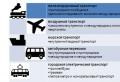 Compulsory personal insurance for passengers Insured for compulsory personal insurance for passengers
 Modern approaches to forming a tourist image of a territory
 Audio fairy tale The Snow Queen


